|
–Geoff-Hart.com: Editing, Writing, and Translation —Home —Services —Books —Articles —Resources —Fiction —Contact me —Français |
by Geoff Hart
Previous installment: July 3, the road to Skaftafell
Today was "Iceberg Day", not to mention a certain American holiday. Our primary activity was to cruise among the icebergs that have calved off of Breithamerkurjökull, one of Vatnajokull's southern outlet glaciers. They fall into glacial lagoon Jökulsárlón, created when the glacier's moraine dammed the lower end of a valley and blocked the water's escape into the ocean. Although the moraine eventually did rupture, forming an outflow river with a powerful current, the lagoon remains 300 or 500 feet deep, depending on who you listen to.
Getting there from Skaftafell is about an hour’s drive in good weather, but you have to pass a headland that Dick said is the windiest in Iceland. He told us that the previous year, the wind had blown so hard that his tour group didn’t dare risk the drive, and just stayed close to home; the next morning, when the wind had died down, they saw one of the tourist buses that had been caught in the windstorm. Its windows had been smashed out by flying rocks propelled by the wind, and several camper trailers had been blown off the road and onto their sides.
We had no such difficulty, though for obvious reasons, Dick was keeping an anxious eye on the weather before we left. The day started out not too promising, with a wall of fog lurking just offshore and low cloud scudding over the lagoon by the time we got there, but by mid-day, the fog had disappeared and the clouds risen, so everything was nicely illuminated. Shoshanna pointed out electronic signboards by the side of the Ring Road, just outside the hotel, that provide real-time measurements of temperatures and wind speeds along the road so you can decide for yourself whether it’s safe to proceed.
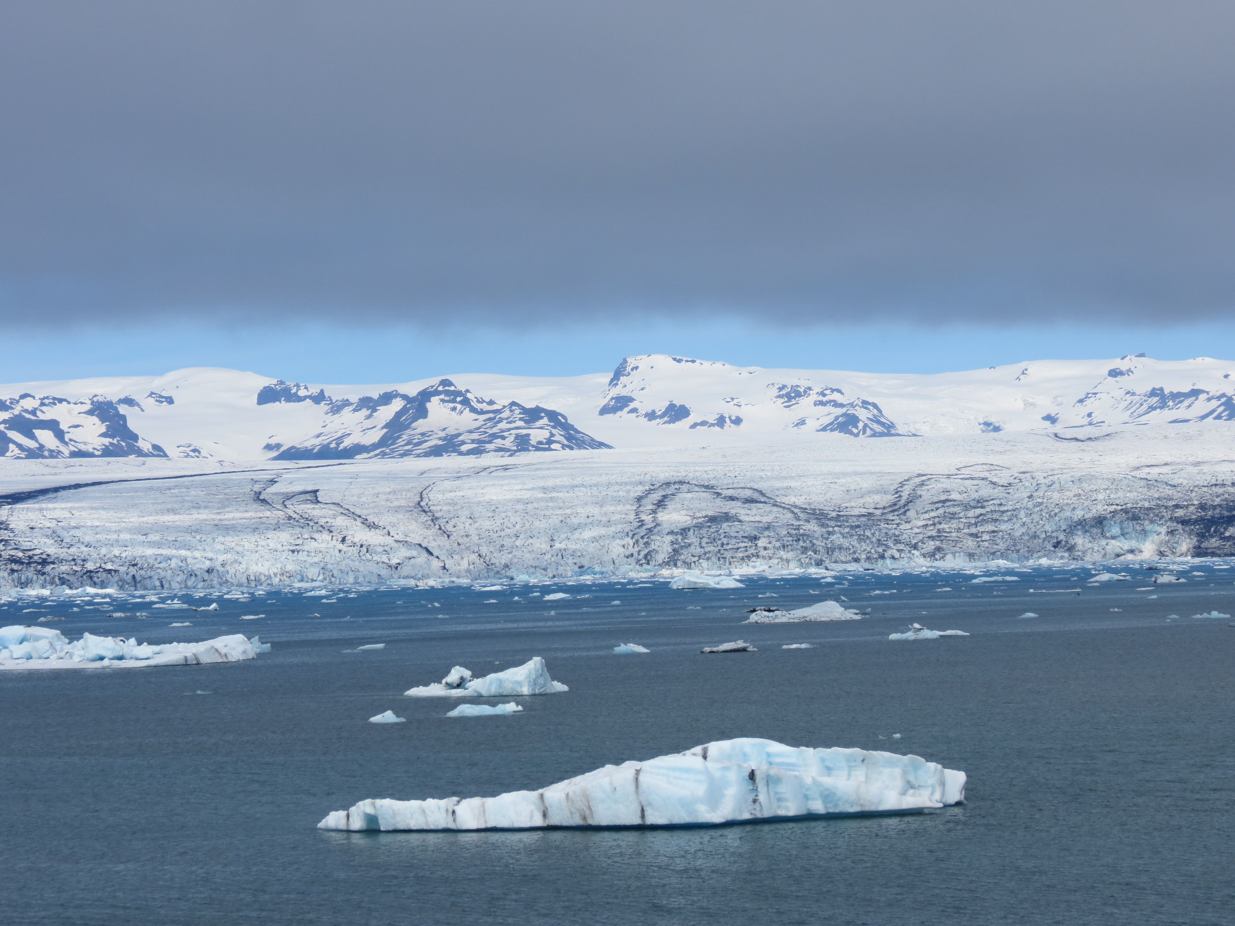
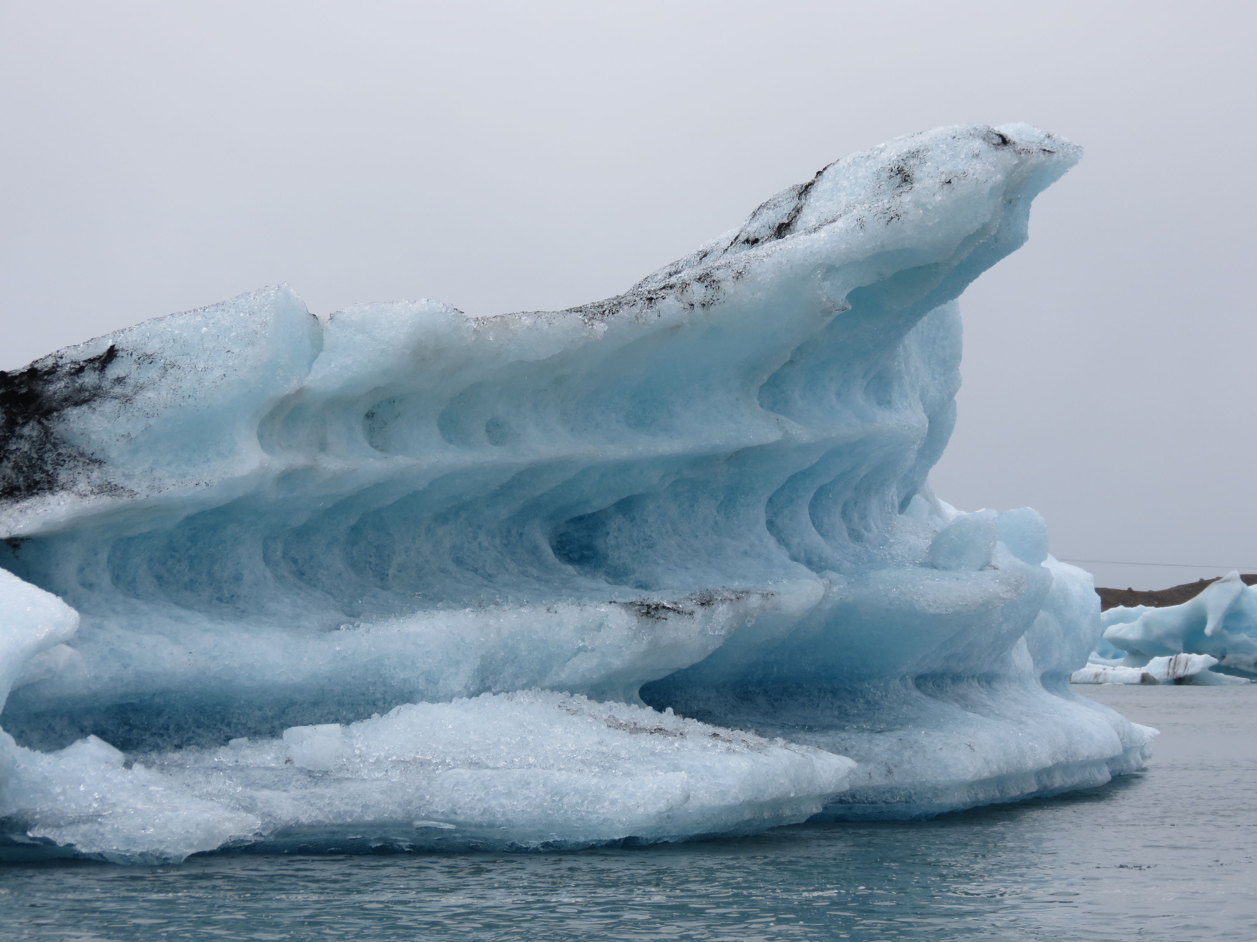
The Breithamerkurjökull glacier is lovely, but no more so than the dozen or so similar glaciers that we passed along the way to Jökulsárlón. Its primary distinction is the large lagoon, which appears to be about half a mile across. The river that joins is to the see seems to be about 100 feet across. The icebergs that fall from the glacier and into the lagoon are pushed and pulled across the lagoon by the powerful outflow current created by meltwater until they exit the lagoon at high speed (about a fast run) and are propelled out into the ocean. There, the strong onshore wind and associated cross-shore current catches them and pushes them onto the black-sand shore, where they slowly melt.
Along the way, many run aground and remain stuck fast until a collision with another fast-moving berg or simple melting frees them and let them take their own turn rushing to the ocean. The bergs range in size from a large armful of ice to bergs the size of a tourist bus. Of course, that description is based entirely on what we could see above the waterline, which may represent only 10% of the total size. (As in the saying "the tip of the iceberg", the majority of the ice is below the surface.) Here’s what the lagoon and glacier looked like as the sky began clearing (the grey smear across the top is low cloud):
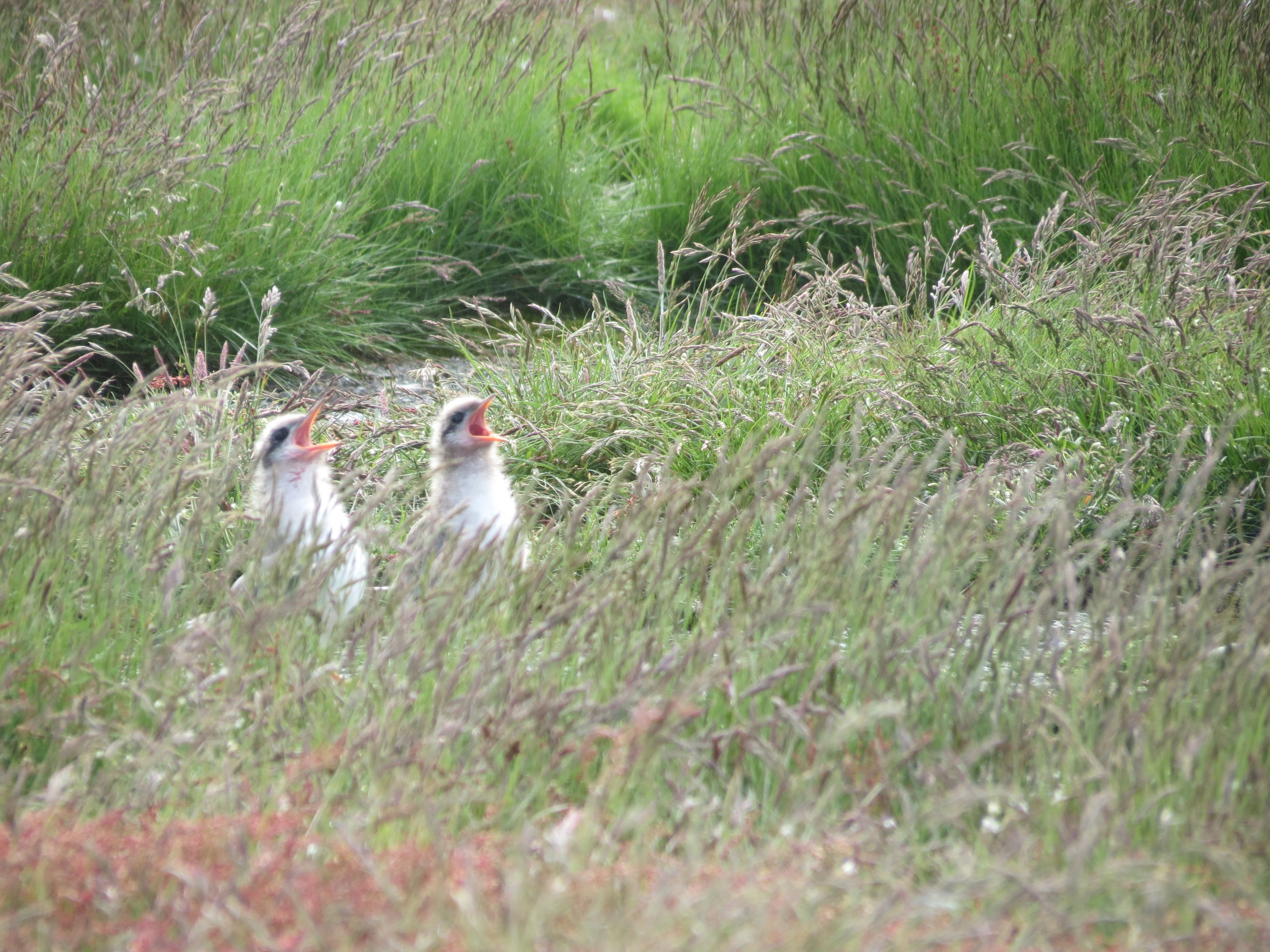
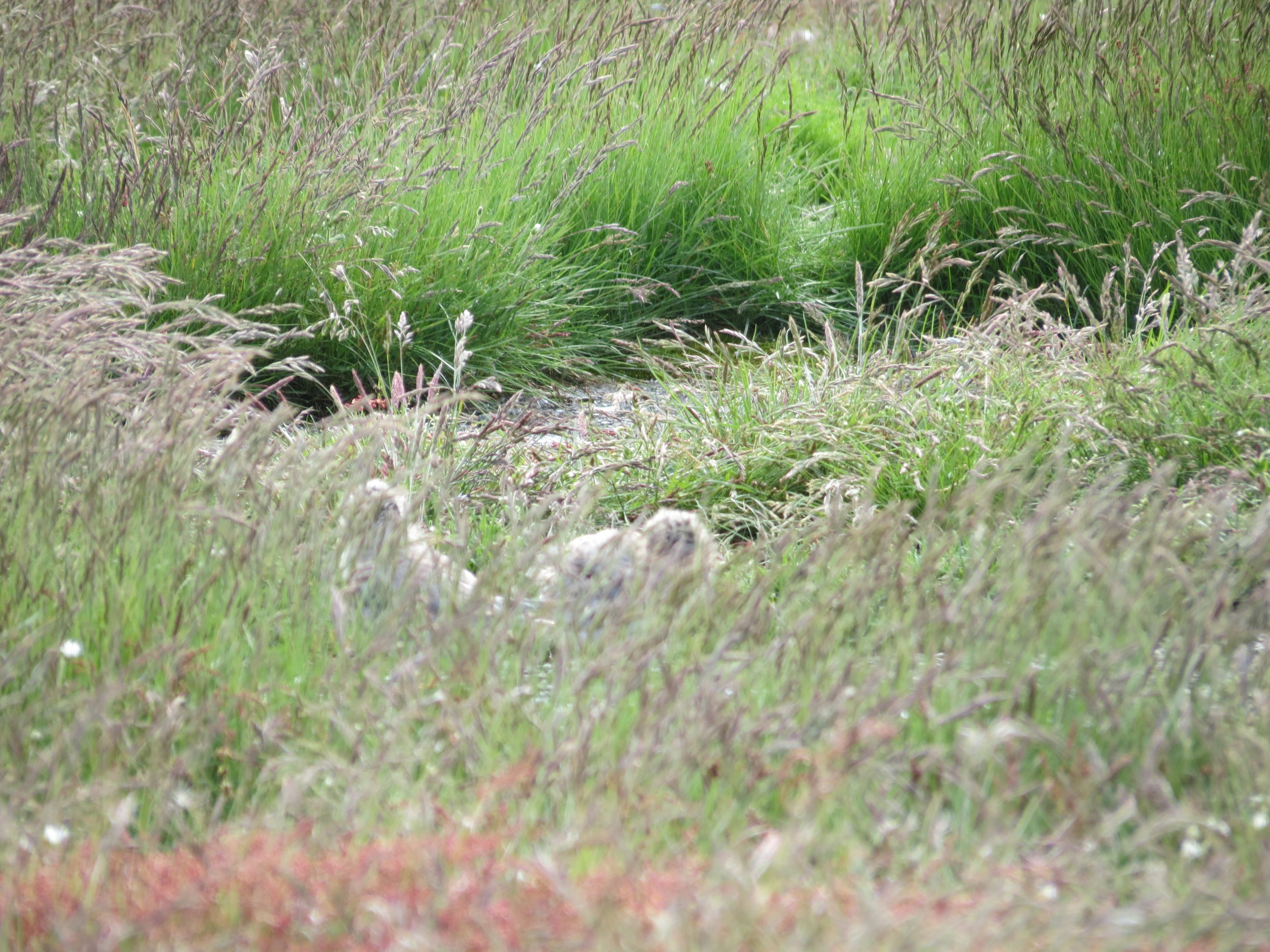
While we waited for our turn on the amphibious vehicle that would take us around the lagoon, I wandered over to a patch of grass near the parking lot where a blizzard of terns was wheeling through the air. Turns out they had “nests” (really not much more than crushed patches of grass) and chicks; most broods were single chicks, but there were a few pairs of chicks. I didn’t want to get close and disturb them more than necessary, so I took pictures from maximum telephoto range. I ended up with several decent shots, but also took a couple shots of the clouds as an adult shot past my shoulder from behind, shrieking outrage and startling me into nearly dropping the camera. Still, none drew blood or did much else other than yell at me for my temerity at approaching their rookery. Upon my return to the rest of the group, I remarked in passing how surprised I was that the terns hadn’t learned the art of defecation on invaders of their territory. This, gentle reader, is what we writers refer to as dramatic foreshadowing. Meanwhile, while you wait for my inevitable comeuppance, here's a shot of the ridiculously cute and floofy (and clearly hungry) chicks, and another to show how well camouflaged they are when they aren't demanding dinner:
Then it was time to take our tour of the lagoon aboard an a four-wheeled amphibious vehicle vehicle that also serves as a boat. Here’s a shot of our faithful steed:
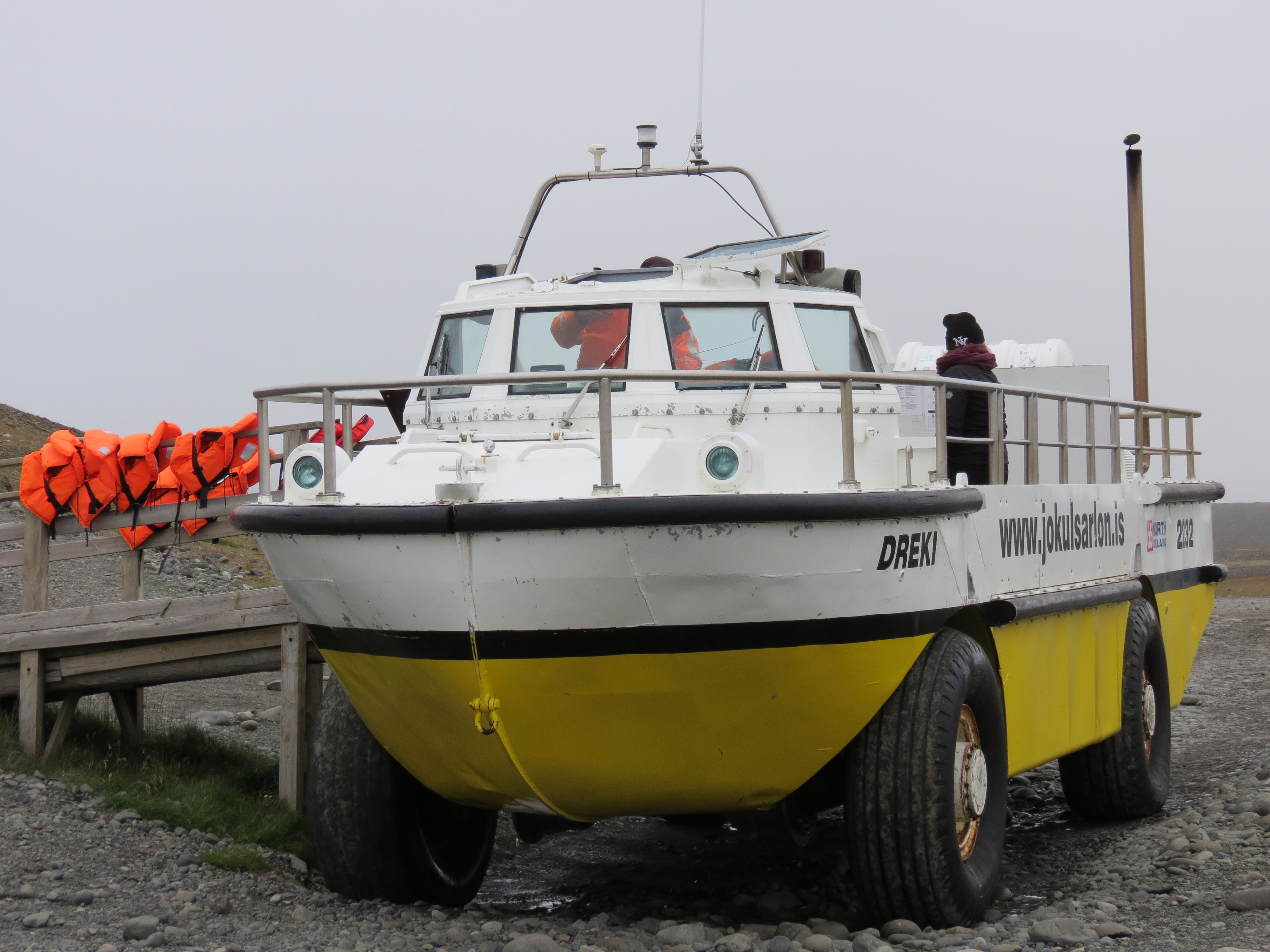
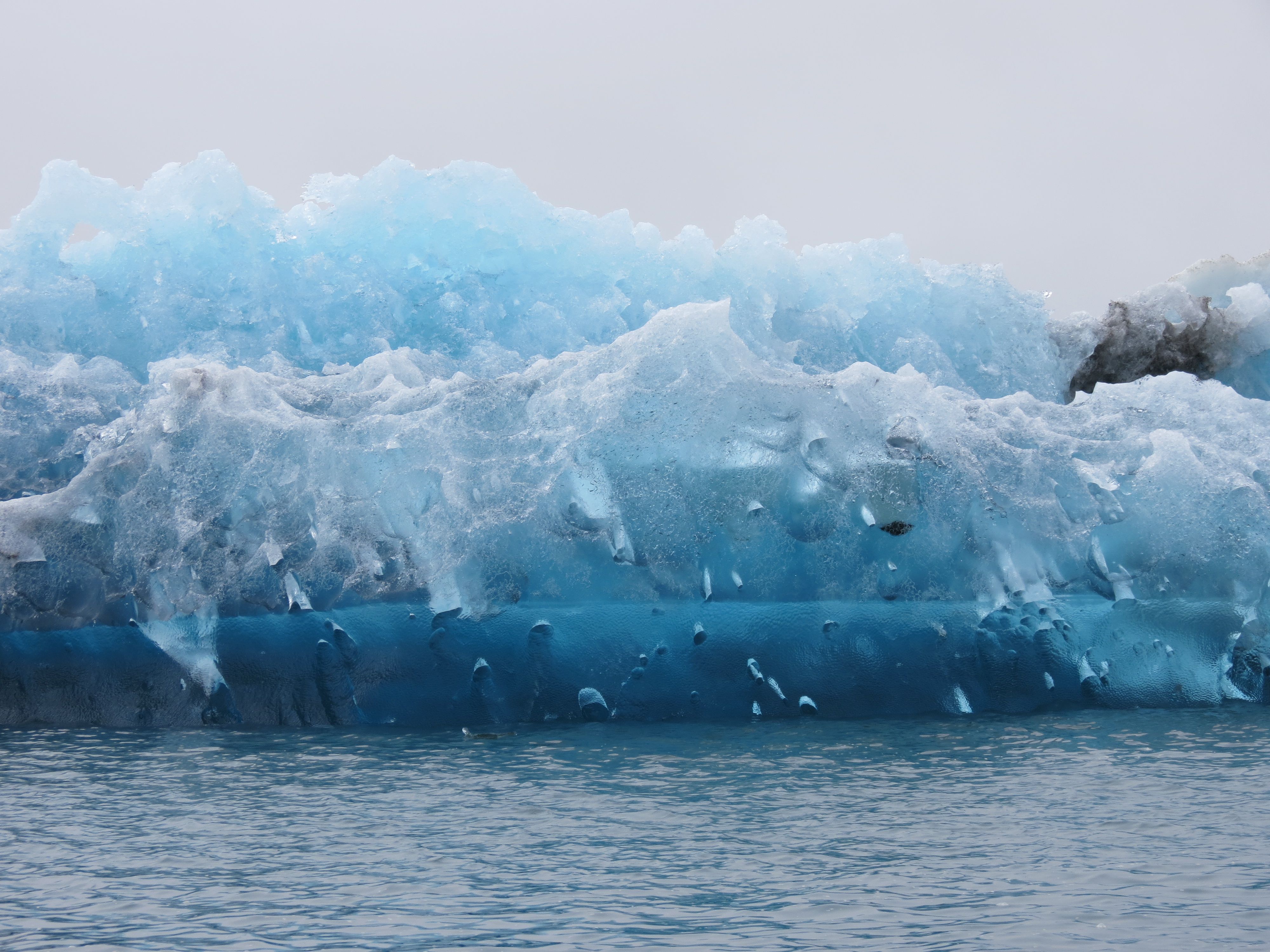
The tour lasted about 40 minutes. Our guide, a Spanish student from Barcelona, told us that it took about 1000 years from the time a given snowfall was deposited on the slopes to the time the ice it became finally slid downhill into the lagoon. We also learned that the bergs with blue ice represented those that had been in the lagoon for the shortest time; the ice turns blue while in the glacier, under pressure high enough to force out most of the air and leave the ice in an amorphous (non-crystalline) form. Once released from the glacier, the ice gradually turns white as sunlight and the released pressure allow it to recrystallize. Though our guide offered an opportunity to taste some ice he’d hauled up out of the water, I declined. It was probably perfectly safe, but I’ve read enough scare stories about the things that live in glacial ice that I chose not to. Shoshanna sampled some, and seems fine. (Cue the music from John Carpenter's The Thing...)
Interestingly, although the guides wore full survival suits in case they fell into the water, all we were offered was a lifejacket. That’s in contrast to the full survival suits we were offered for whale-watching in Reykjavik Bay, which seemed a safer trip (i.e., no icebergs to threaten a surprising swim). Because the water temperature in the lagoon ranges between 1 and 5°C during the tourist season, you won’t survive more than 5 to 10 minutes if you do something touristy like standing up on the seats to take a picture and fall into the water; given that context, lifejackets seem inadequate. Instead, they have “chase boats” (zodiac-type inflatables with powerful engines) that tag along behind each amphibious vehicle so they can fish you out of the water and rush you to shore for emergency warming should you fall in. Here are a couple shots of the bergs to give you an idea of their range of color and shape (the first is about 10 feet tall; the second about half that):
The only disappointment was that they didn't take us right up to the face of the glacier, but I imagine that during the spring and summer, when the ice begins melting, it's not a safe place to be. The wave produced from a single really big berg dropping into the water could flood or capsize a boat.
After the boat tour, we had some time to roam around before driving down the road to “iceberg beach”, where the bergs that escape the lagoon come to rest. While other members of the group went for a bathroom break, I ran back to the tern nesting area to try for a few shots from closer in. And now the plot device that I dangled earlier in this blog entry was made manifest, for I seem to have inadvertently passed some invisible boundary that I'd respected during my previous visit to the rookery. I quickly learned that the terns have indeed learned the trick of dive-bombing and defecating on overly curious tourists. As I raised my camera to scope out the nesting area, I was hit at least twice on the head, once on my camera hand, and a couple times on my polartec vest. The one time I’d forgotten to bring (and wear) my sun hat was the time I could really have used one!
I beat a hasty retreat, returned to the bus to reveal my woeful condition to the appreciative members of the group, and waited while Shoshanna bravely de-defecated me. Apart from an ammonia smell and the ick factor, it wasn’t such a horrible experience, and as I was washing up in the bathroom, a sympathetic fellow tourist told me he’d suffered the same fate. According to the guide who had rescued him, being “blessed” by the terns was a sign of good luck. The rest of the day was gorgeous, so perhaps so.
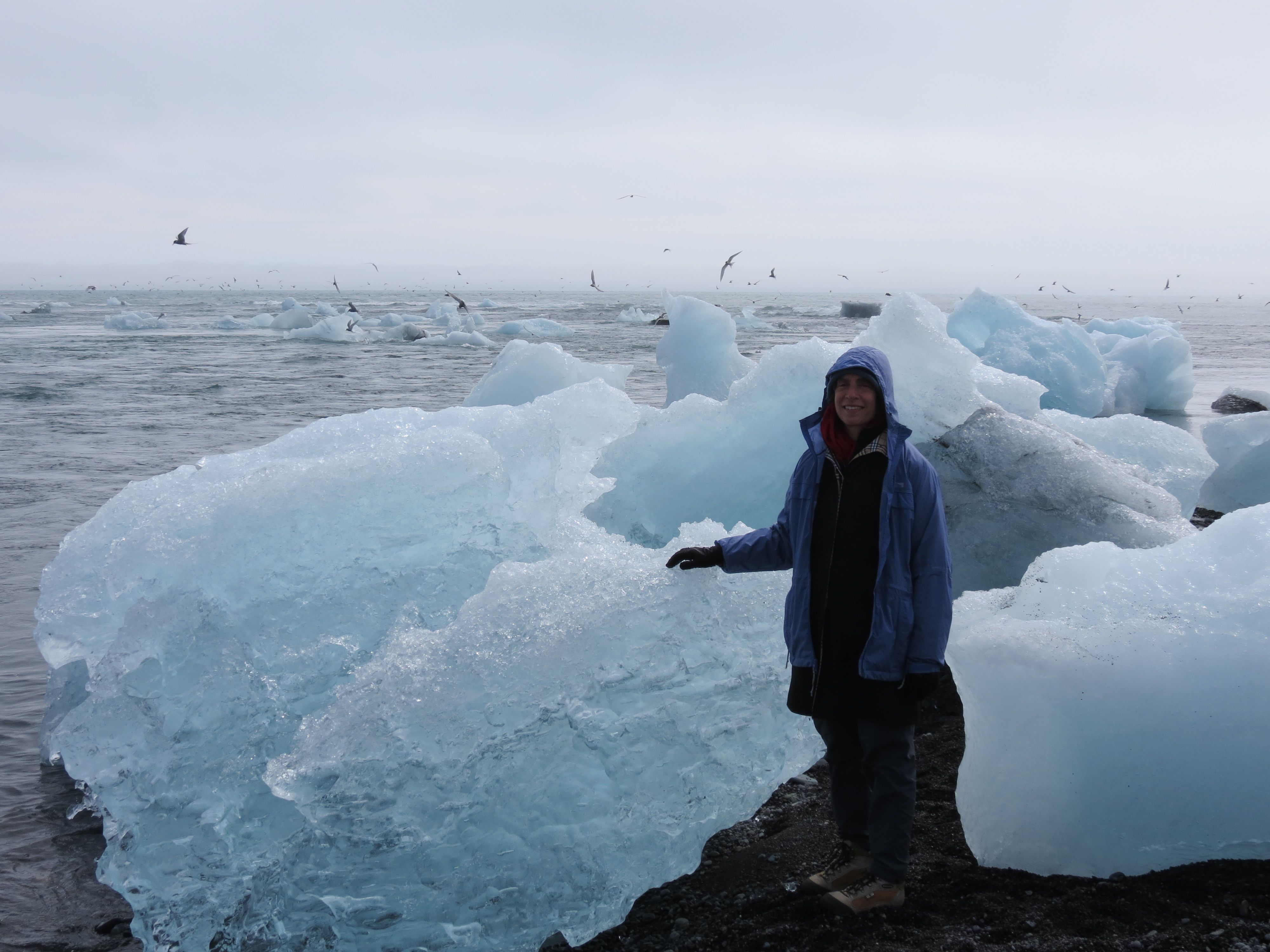
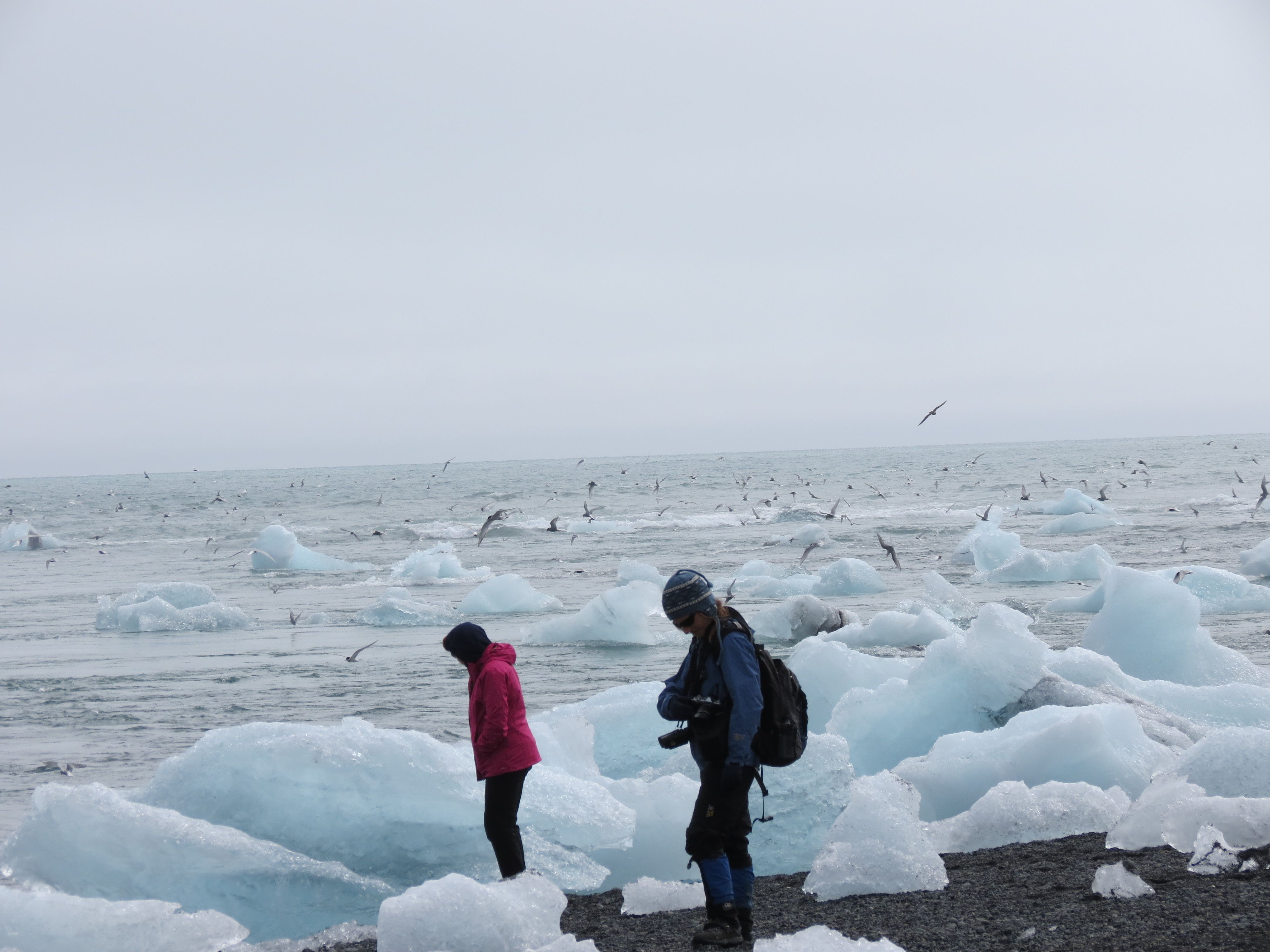
On the beach, we roamed a while amidst the beached bergs (some taller than we were) and watched the terns diving into the water. Again, there was a veritable blizzard of terns, but this time they were diving into the frigid waters to catch their dinner. They seemed to be catching things that looked like worms or very long and thin fish. Possibly herring, according to Shoshanna’s interpretation of one of the tourist info signs. We also spotted a seal fishing among the terns, and beautiful but sinister brown skuas harassing the terns. Mostly the skuas seemed to be trying to get the smaller birds to drop whatever fish they’d caught, but as skuas are also serious predators, they may also have been hunting the terns. Here’s a shot of Shoshana with the beached bergs, and another of the terns feeding among the bergs:
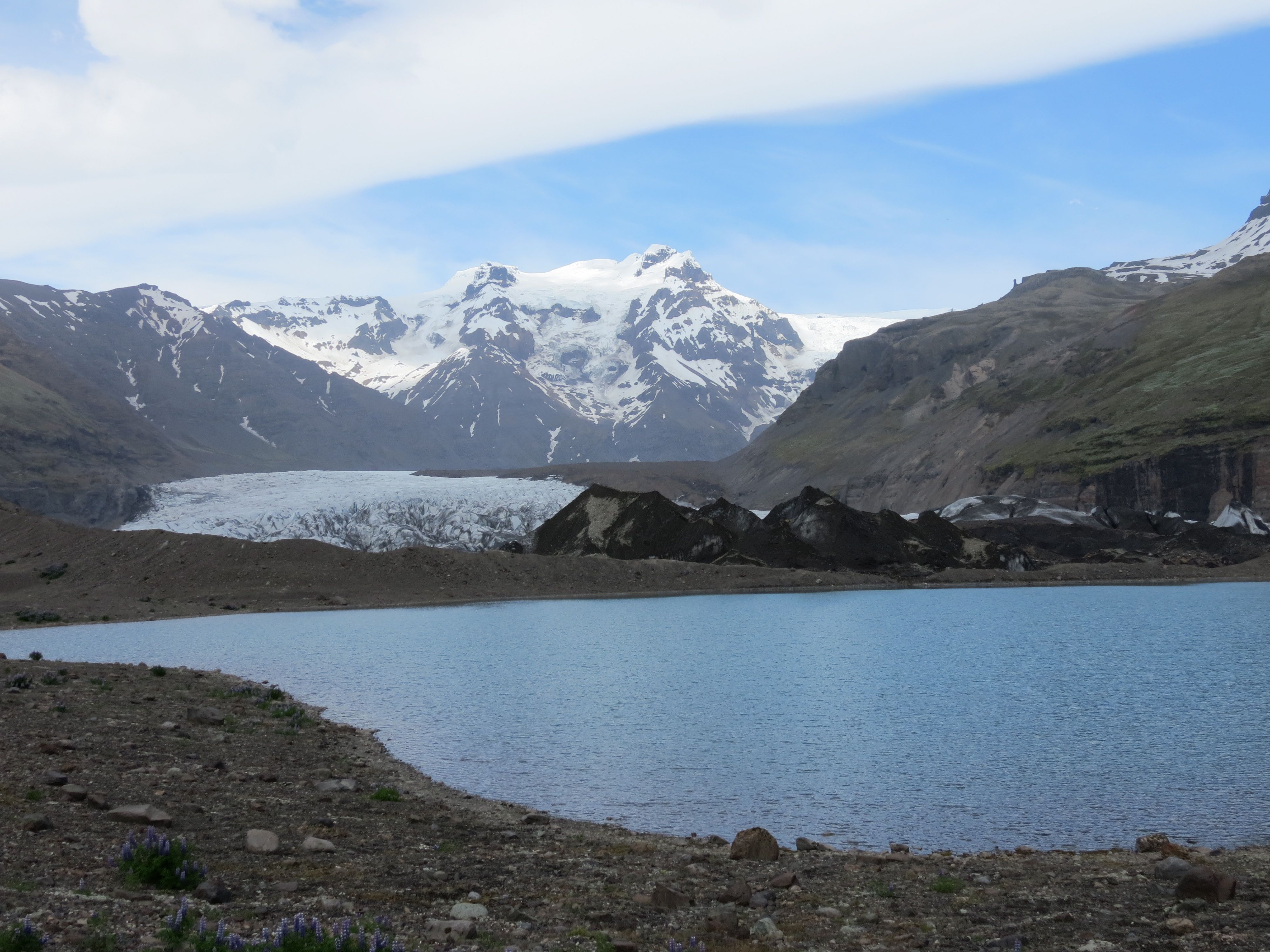
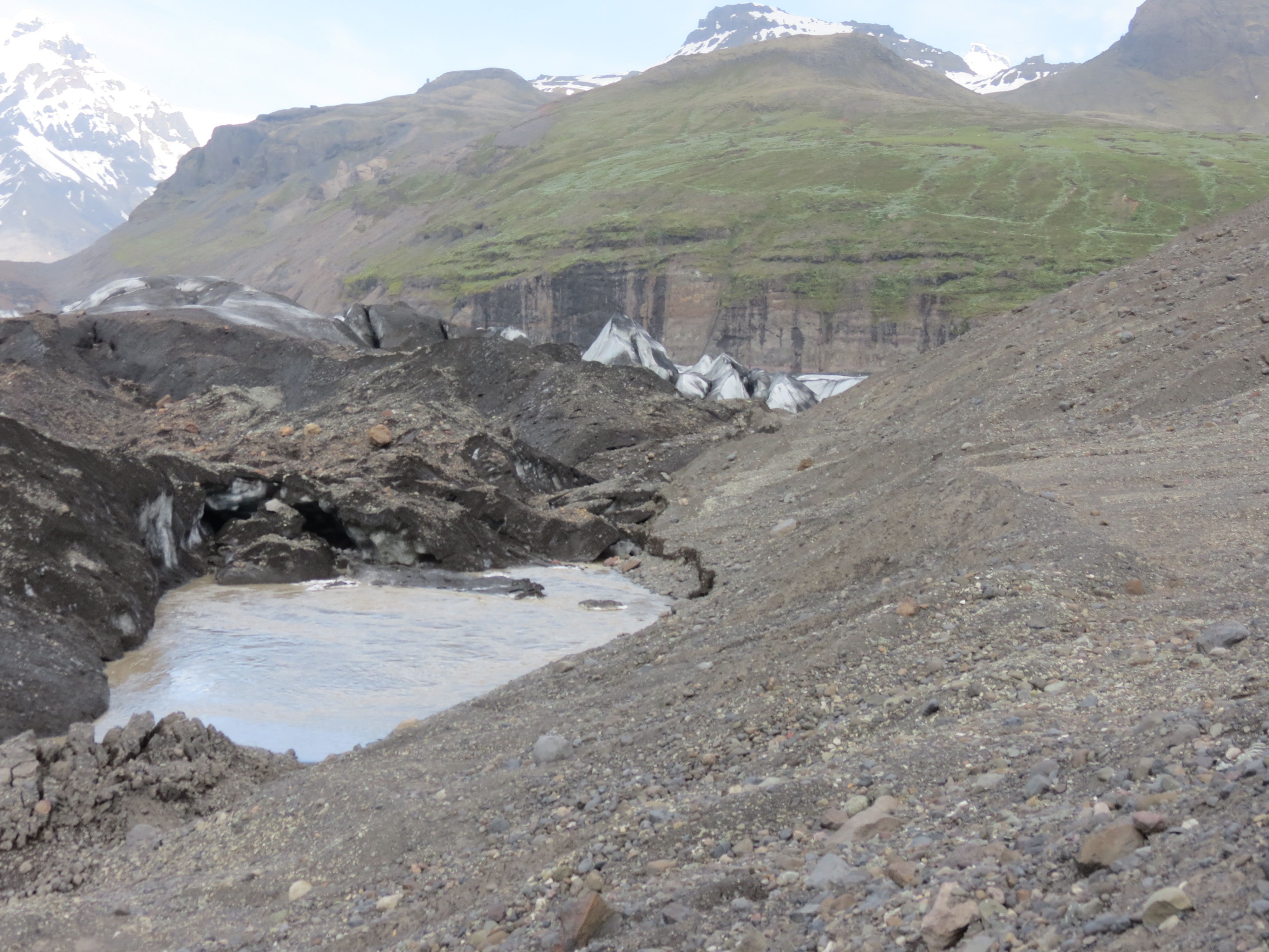
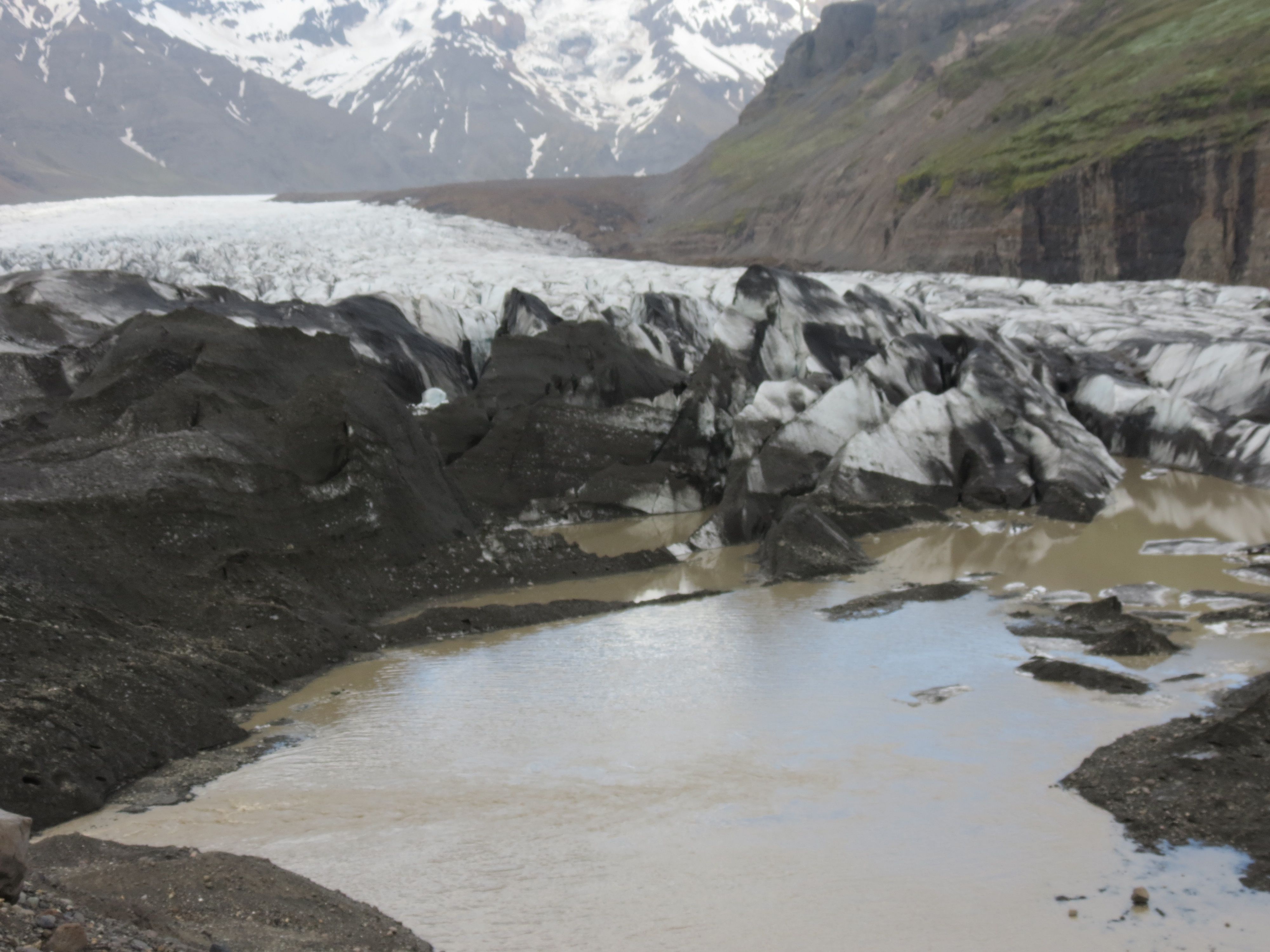
Our last stop of the day was back at the hotel, just long enough to freshen up before hiking closer to the beautiful mountain that lies behind the hotel. So far as I can tell from the map, this is Öraefajökull Mountain and its associated glacier, which we’d seen from a distance the previous night. Today, we went right to the foot of the ice field, passing through a nested series of moraines that represented different periods in the glacier’s history of recession since the last ice age and since Europe's "little ice age". We stopped briefly at a small proglacial lake (proglacial = lying before the glacier), then above at a tiny one where a strong upwelling in the water revealed the presence of a spring produced by glacial meltwater flowing beneath the glacier then returning to the surface. We continued in the direction where the water was leaving this smaller lake and passing through what Dick described as a “tunnel” under the glacier. The water then emerges in a much larger proglacial lake, complete with small icebergs, that is fed by inflow from the spring farther uphill. Here’s the first of the proglacial lakes, the lake with the upwelling (at the top side) and outflow (right side), and the final lake plus fractured ice at the end of the glacier:
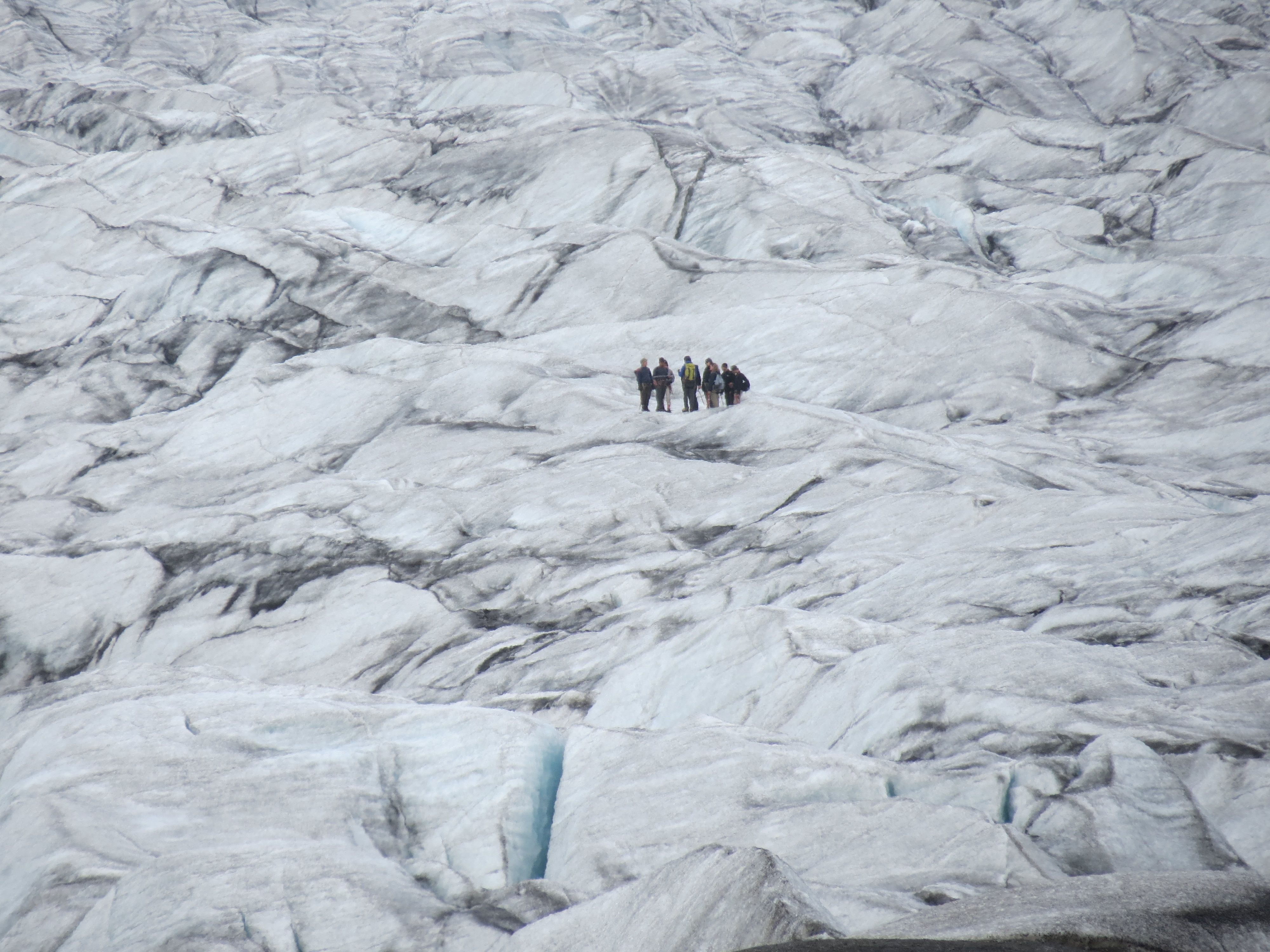
The scale of the icefield is immense. It doesn’t seem so large from down below, but we spotted a group of glacier hikers off in the distance that put things in perspective: even at maximum zoom, they were still ant-like figures on the ice:
Returned home for a shower, a pint of Viking Classic in the bar, which provides a pleasant view of Öraefajökull Mountain and its glacier. The Classic is as good as the regular Viking beer we’d tried before, but darker. After chatting a while with other members of our group, we headed across the highway to the truck stop to try their dinner options. We both settled on lamb burgers with fries, and though expensive and small by North American standards (think quarter-pounders rather than the half-pound burgers you’d expect for a lower price than we paid), they were tasty and definitely cheaper than the food at our hotel.
After dinner, straight home and early to bed, since tomorrow will be our free day for hiking in Skaftafell National Park.
Next installment: July 5 in Skaftafell park
©2004–2024 Geoffrey Hart. All rights reserved.