|
–Geoff-Hart.com: Editing, Writing, and Translation —Home —Services —Books —Articles —Resources —Fiction —Contact me —Français |
by Geoff Hart
Today’s plan was to visit the Landmannalaugar nature area, which is located a considerable distance east of Reykjavik, in the interior highlands of Iceland, just east of Hekla, Iceland’s most active volcano. Hekla tends to erupt every 10 years or so, and is currently a few years overdue. Cue the dramatic theme music if you’re of a melodramatic bent.
Getting to Landmannalaugar is a long drive (about 2 hours), and requires a special “mountain bus”. The main external difference from a regular bus is that the mountain bus seems a bit more snub-nosed and is raised significantly higher off the ground so that it can ford the many streams that cross roads in Iceland’s interior. (These are gravel, sometimes but not often consolidated with a bit of tar or other sticky stuff.) The bus is not quite as aggressively rugged as the “superjeeps” that I’ll describe in tomorrow’s blog entry. Presumably it also has a more powerful motor or a transmission with better low-rpm torque to provide the power needed to deal with steep slopes and loose gravel roads. In any event, we had no significant problems along the drive.
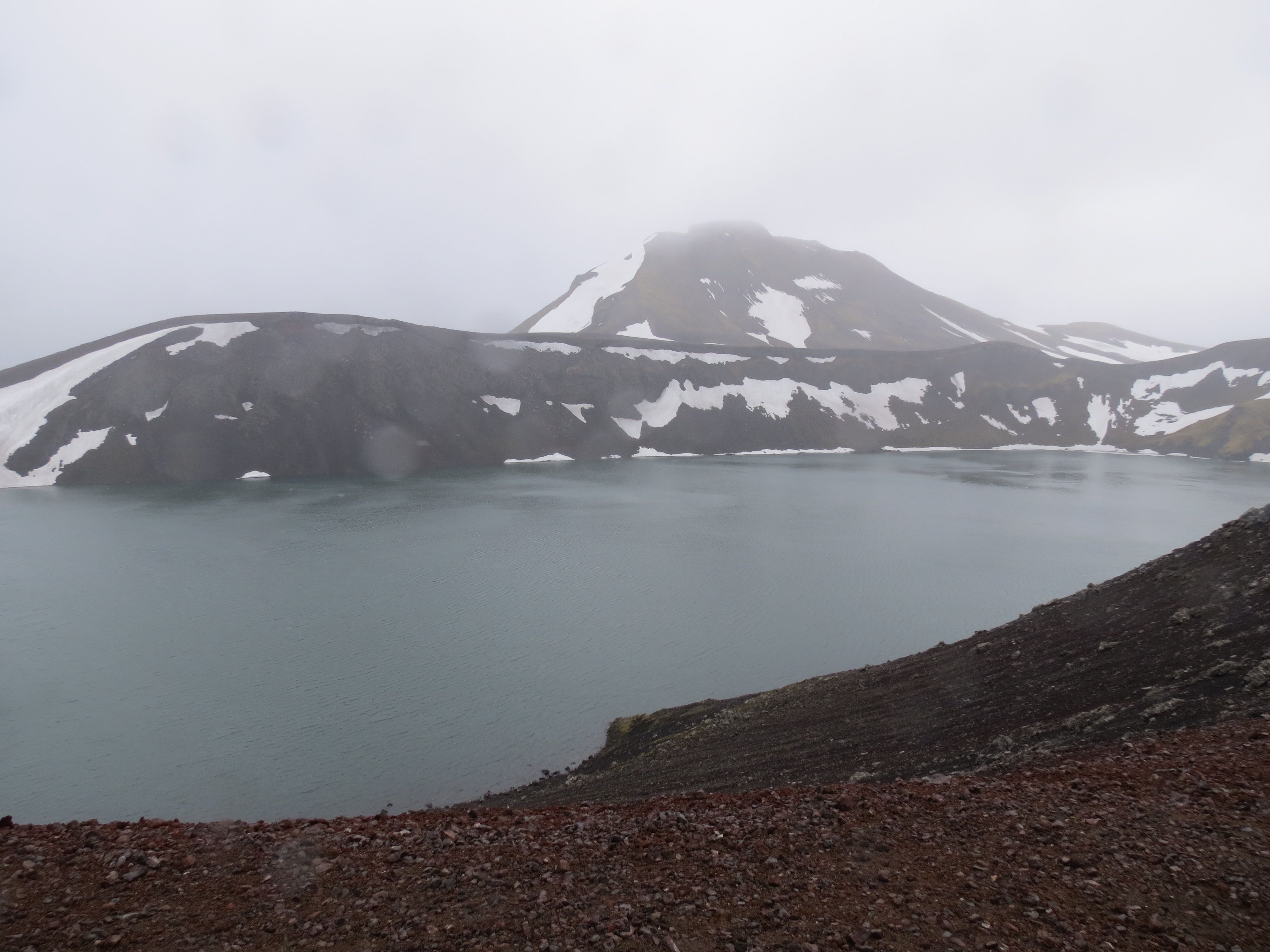
Our first stop on the way was at a volcanic blowout crater, where emerging lava had contacted groundwater, converted it to superheated steam, and blown the lid off the land. The result was an elegant crater lake, now filled with lovely blue-green water. Here’s what it looked like:
crater-lake.jpg
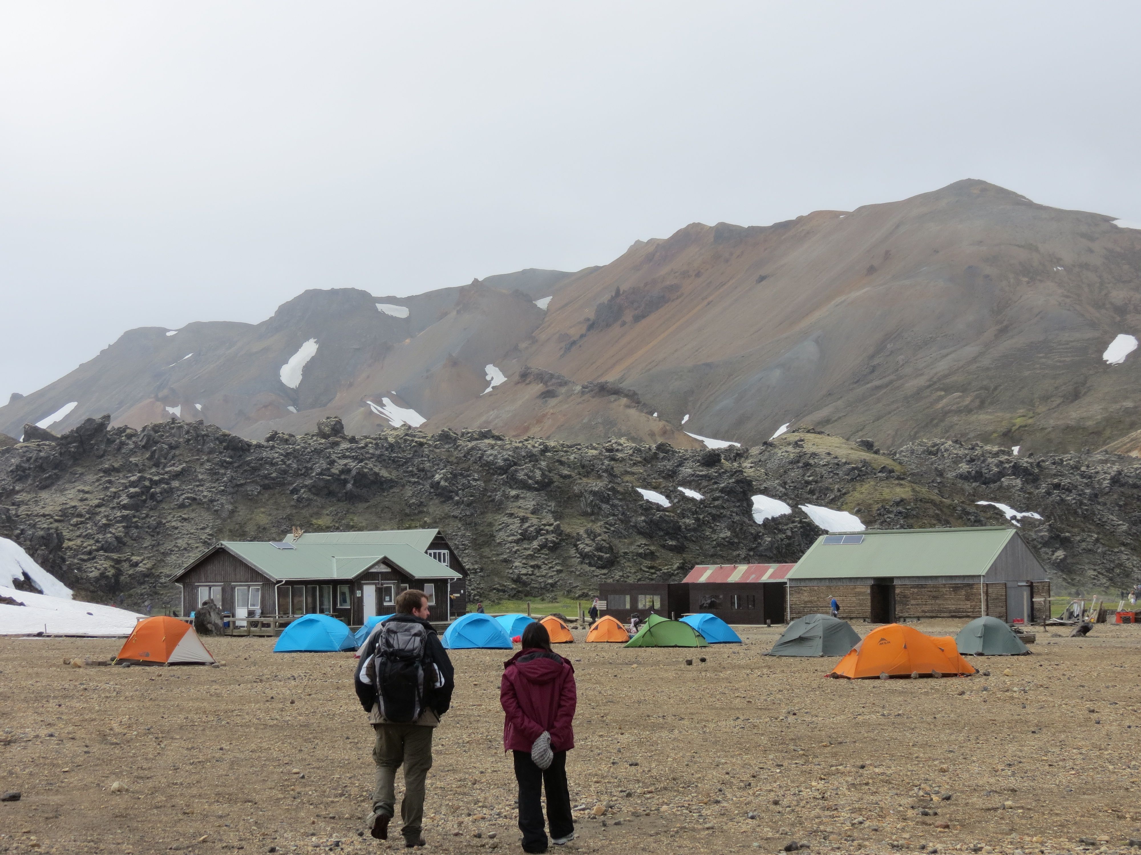
One of the attractions of Landmannalaugar is the hot springs, which occur (surprise!) amidst a spring running down from the mountains. There are fumaroles higher up the slopes too, but we'll get to those presently. These hot springs are less of a formal thing than would be case at a spa; there’s a hut where you can change into swim trunks, and after that, you can just dangle your feet in the water or go for a dip. We chose not to take advantage of the springs this time, as the area is generally crowded, it would have involved dealing with bathing suit and towel, and it would have cut into the time available for hiking.
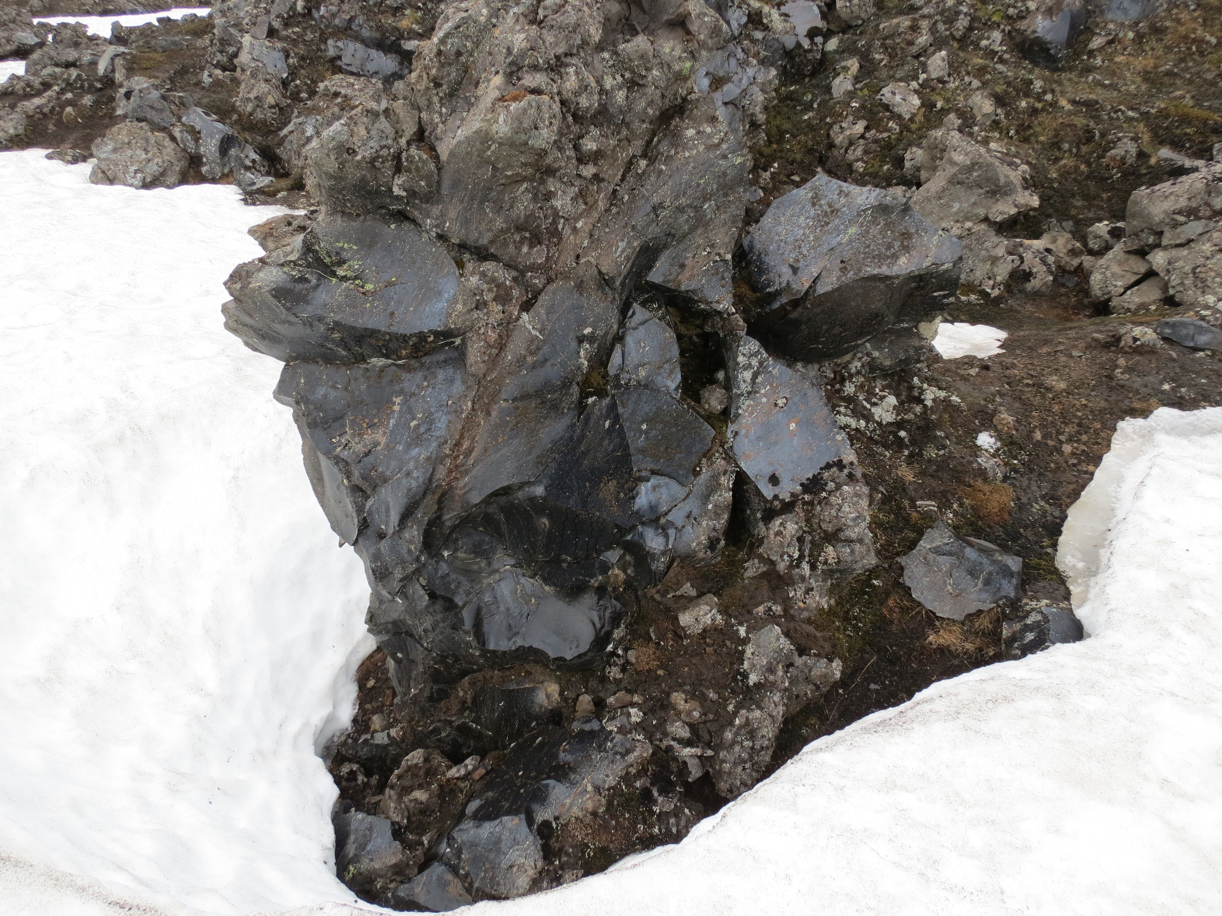
The main attraction that brought us here is a large obsidian lava flow that spills down the hillside. Obsidian forms when lava cools so rapidly it doesn’t have time to crystallize, so instead it turns into volcanic glass. The glass is so strong that it can be cut into flakes that hold an edge that is reputedly better than modern surgical steel, though more fragile. (It is, after all, glass, not steel.) This doesn’t mean that the lava forms a huge heap of razor-sharp glass shards that we’d be walking through, taking life somewhat carelessly in hand; rather, it forms a jumbled heap of clumps (the a’a’ form of lava), mostly weathered so that unless you look closely, you may not notice it’s any different from ordinary lava. But if you do look closely, you often see the sheen of smooth glassy surfaces, which feel like limestone or glass (depending on the particular surface) to the touch. Have a look at this image (zoom in if need be) to see what the surface looks like:
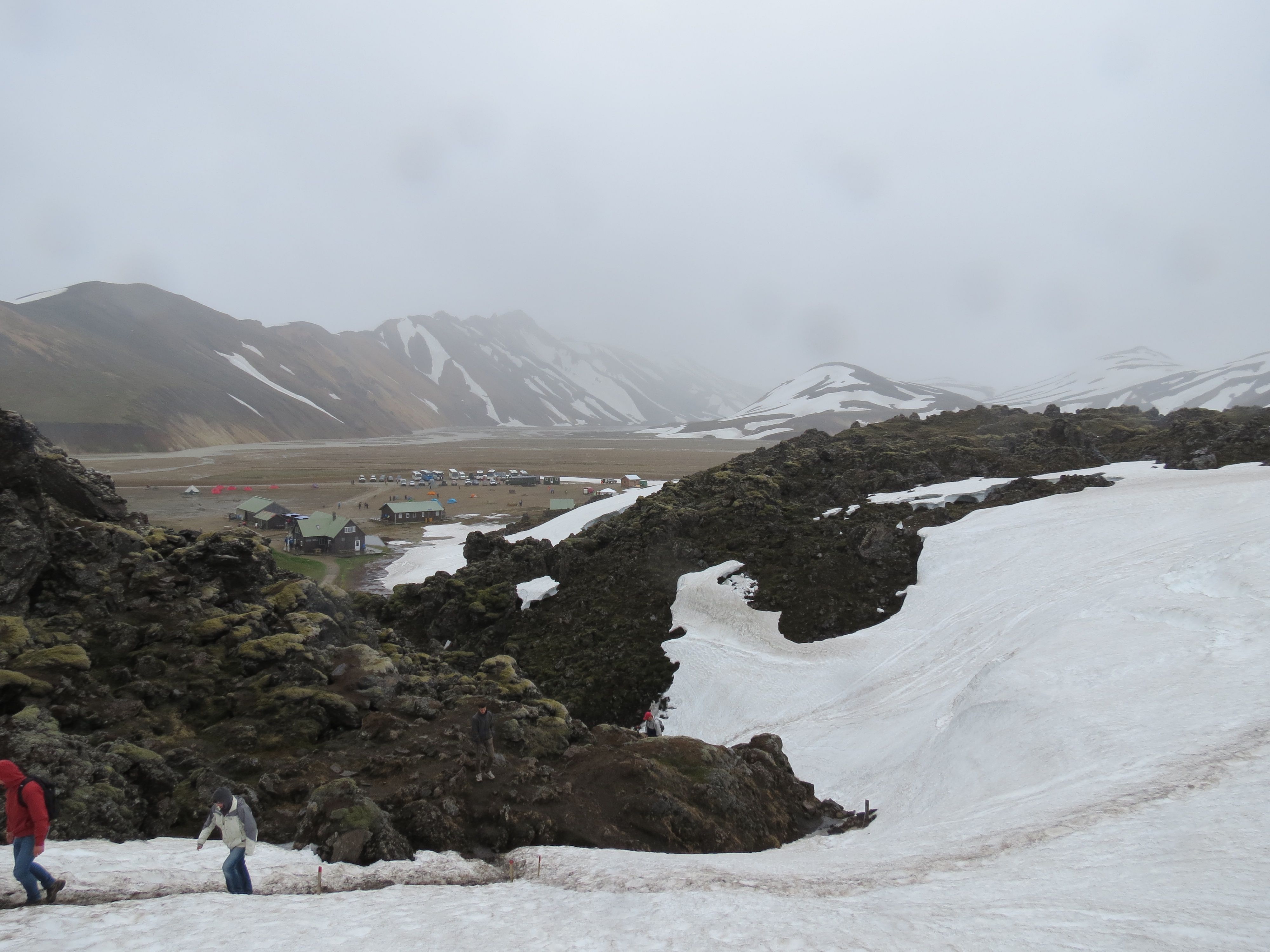
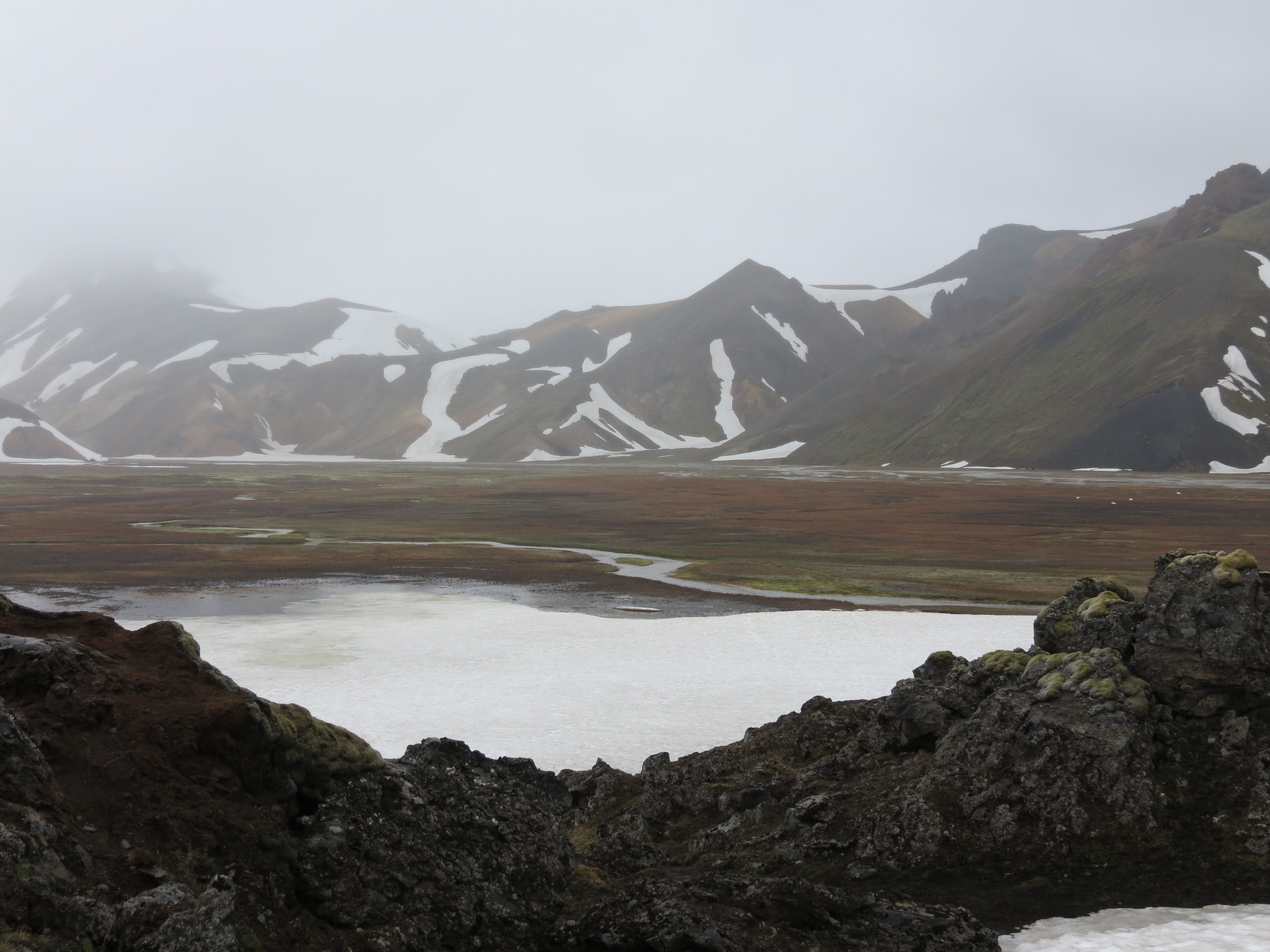
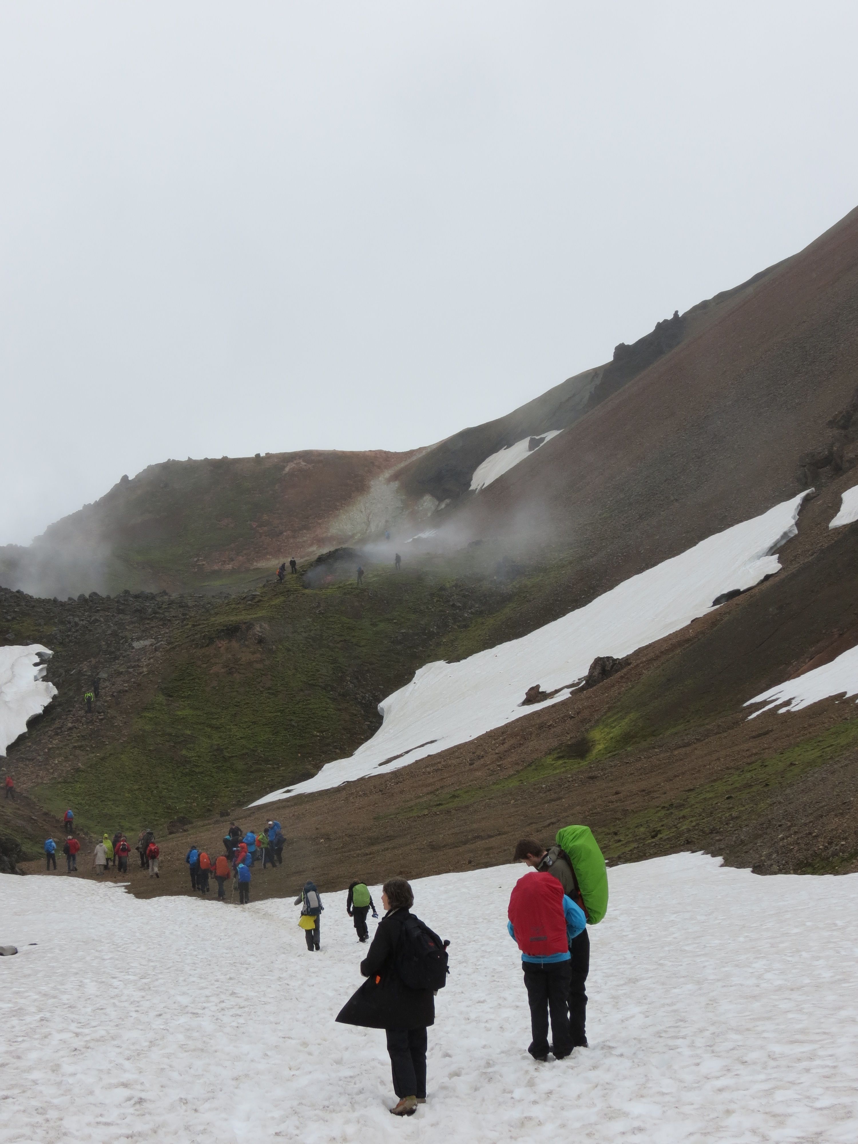
This particular lava field is large enough that the particular hike we chose took about 2.5 hours to complete. The route went up one side of the lava, then back down the other side. So basically call it 1.25 hours worth of steady walking on each side in length, and more than 20 feet in depth at the bottom of the flow. (No easy way to guesstimate the thickness higher on the slopes of the surrounding mountains.) It’s a beautiful hike, with varicolored mountains mixing the black of newer lava with the grey of weathered lava, the yellow of dry moss, and the deep green of moss and other vegetation in the wetter areas. Also, the white of snowfields, since summer seems to be late getting started this year. Here’s an example from the early stage of our hike, looking back downhill at the parking lot and park office and a second shot of some alpine wetlands about midway to the top:
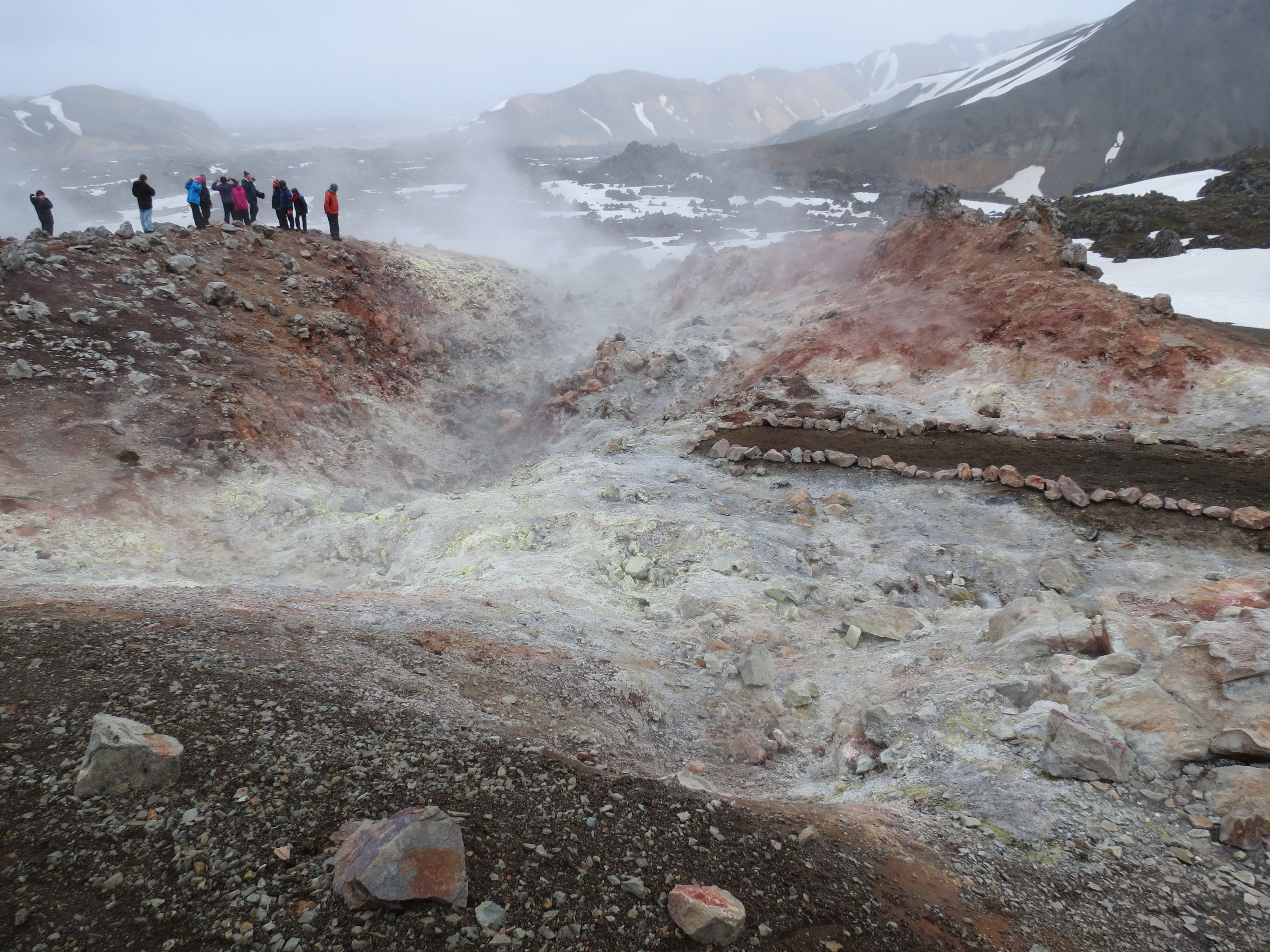
The top of the hike is in a region with many hillside fumaroles, suggesting that there may be more lava in this area's future. You can see them steaming from quite a distance, and smell the sulfur when the wind is blowing right. Here’s a look from downslope, and one from up close, showing deposition of sulfur (yellow) and other minerals:
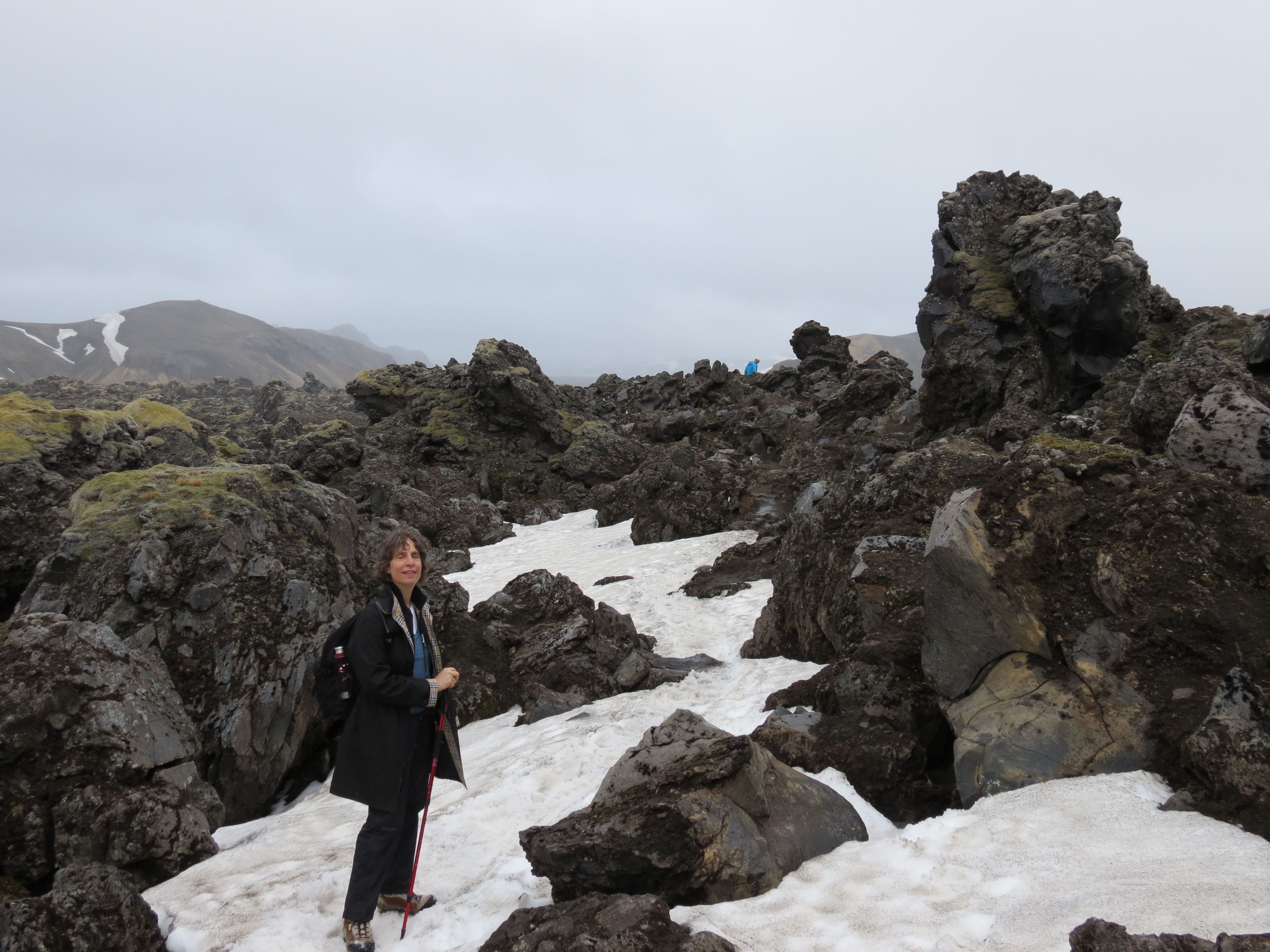
The trail wasn’t well marked, but we did eventually find the turning point and start downslope through mixed fields of lava and snow. Here’s Shoshanna in a typical patch:
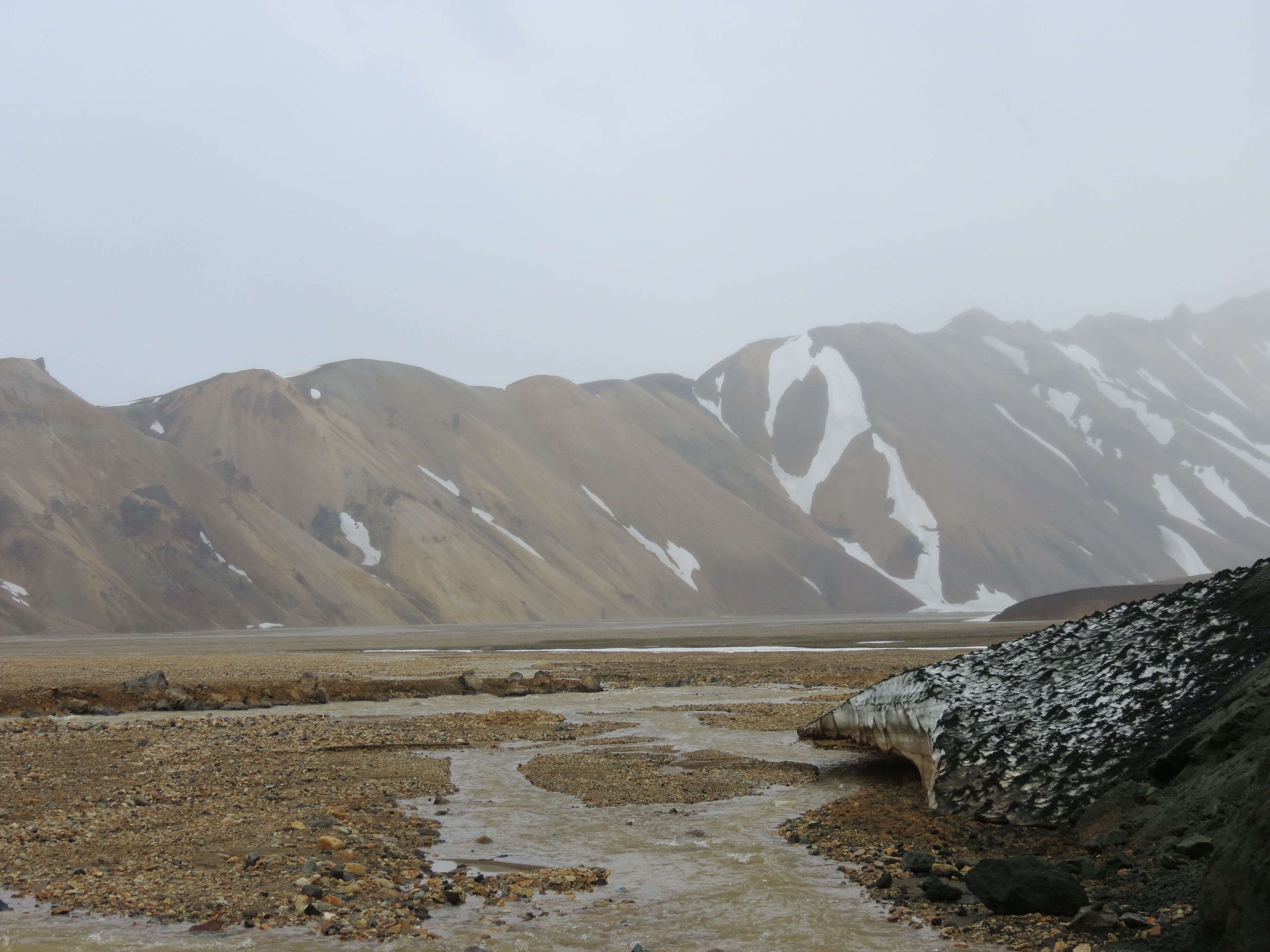
The last stage of the hike is beside a lovely torrent created by meltwater from the surrounding snow fields, which empties onto an outwash plain covered with cobbles and gravel. Here’s a shot of the upper stages of the torrent, and one of the outwash plain:

And just to provide some sense of scale, here’s the end of the hike, showing the lava that flowed down to the outwash plain:
Long, uneventful drive home, arriving at the hotel around 6 PM. Dinner was at the Eldstó Art Café. Shoshanna had a cod fillet and I had arctic char, both well prepared and very tasty, washed down with a good porter and white ale. (Sadly, we were too tired to record their names.) I would have tried dessert, but after 15 minutes of vainly trying to catch the waitress’ attention (I couldn’t quite bring myself to shout or walk up and tug on her sleeve), we gave up and paid the cheque. This is early in the post-school season when the young folk are just starting their summer jobs, and the training hasn’t yet taken hold, it seems.
Next installment: July 2nd, Thorsmörk valley
©2004–2024 Geoffrey Hart. All rights reserved.