|
–Geoff-Hart.com:–Editing, Writing, and Translation —Home —Services —Books —Articles —Resources —Fiction —Contact me —Français |
You are here: Home (fiction) --> Channel Islands --> May 21: Guernsey Island
Vous êtes ici : Accueil (fiction) --> Channel Islands --> May 21: Guernsey Island
Dinner at The Farmhouse was a little pricey, but good enough to be worth the price. I had the quintessentially English Beef Wellington, which is tender, slightly pink meat in a pastry crust, with a red wine–meat sauce gravy and deliciously roasted potatoes. (Wellington would have turned in his grave, though as the potatoes were "Lyonnaise" = French.) Shoshanna had sea bass, which was also quite nice. I think I'll order it next time I see it on the menu. Beer for me was Mahou, a nicely refreshing Spanish beer without excessive hoppiness, and Shoshanna had Inch's cloudy cider, an unfiltered English brew. Both were excellent and worth noting for future dinners. We made it home before sunset after a relaxing post-dinner stroll.
Today's goal was to have been a "recovery" hike in which we would stretch our legs to recover after yesterday's exertion, while keeping muscles from stiffening up before our trip to Sark tomorrow. The Sark hike looks to be long, but not terrible. But evil stairways lurk where least expected, so we'll keep a wary eye as we hike.
After some discussion, we chose a hike along the far western–northwestern shore of the island, the coast around Vazon Bay, which we haven't visited yet. It's a longish bus ride (about half an hour), but that gave us a chance to see more of the island en route. The plan was to do a coastal loop in relatively flat terrain (a total elevation change of only 100 m or so). At the end of our hike, we were hoping to cross a causeway to reach the Lihou Island wildlife sanctuary, but this is only possible at low tide, which occurred a little after 4 PM today.
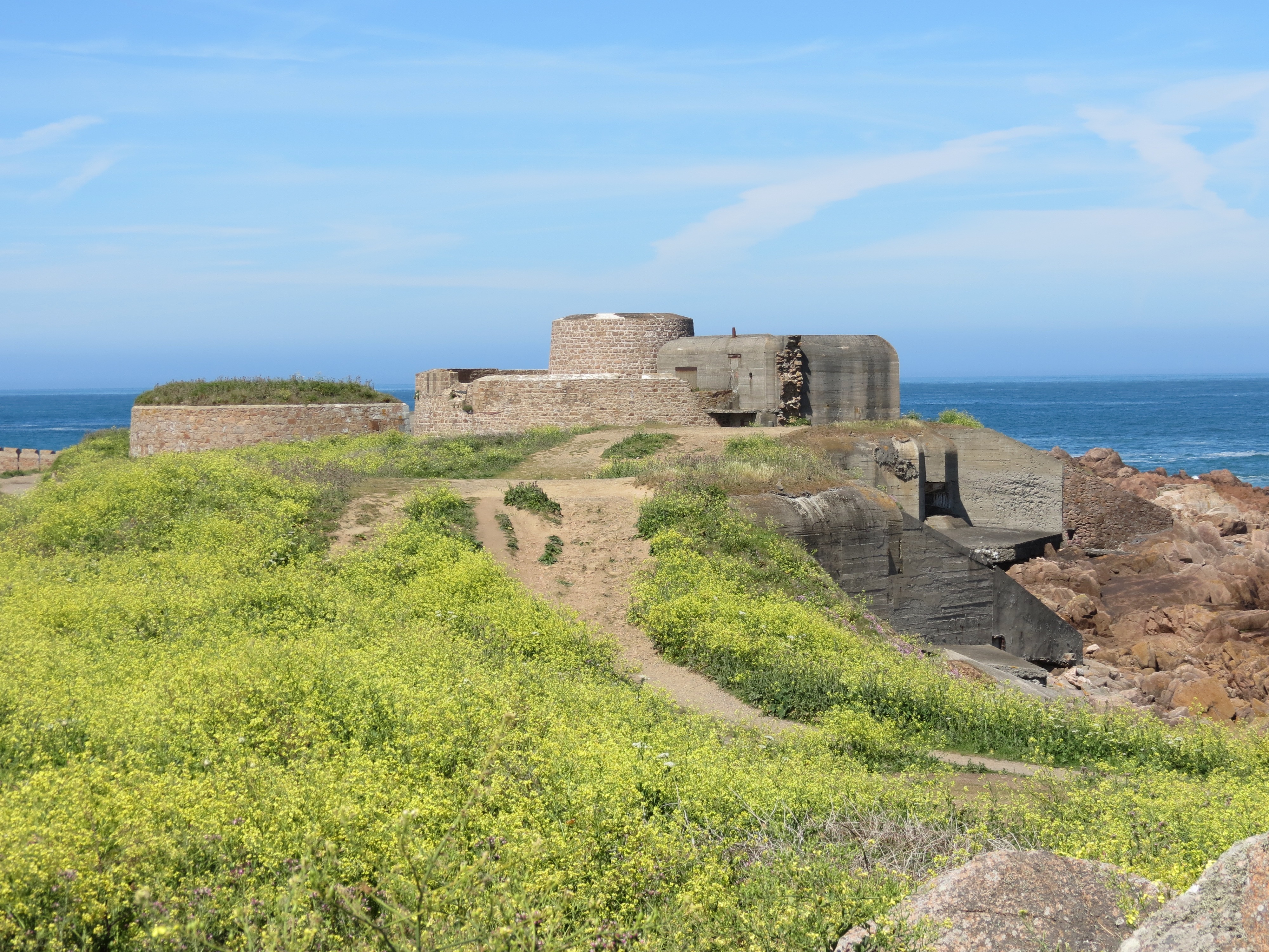
After debarking from the bus, we walked down to Fort Hommet, which offfers a commanding view of the bay. It's one of those forts that was built 500-some years ago, then subsequently rebuilt or added upon to take advantage of new technologies or respond to new political situations. One of the German bunkers built atop the historical fort during World war II was transformed into the Shrine of the Sacred Heart, post-war. Unfortunately, that added an hour or so to what was originally expected to be a 2.5-hour hike. The astute reader will note that this slippage of time became a theme of the day.
Fort Hommet:
The first hour or so of the hike was fine, but that ended when the GPS trail instructions ran into an inconvenient reality: a lot of new home construction was going on along the shore, and this included dumping "riprap" (large rocks used to blunt the force of waves and resist erosion) over a large area after the original GPS route had been recorded. We tried for some time to scramble over shifting and uncomfortable stones in an effort to continue that part of the hike, but it became increasingly difficult. We probably wasted an hour trying before we gave up and clambered up a lower part of the seawall into someone's backyard, and followed their driveway out to the road.
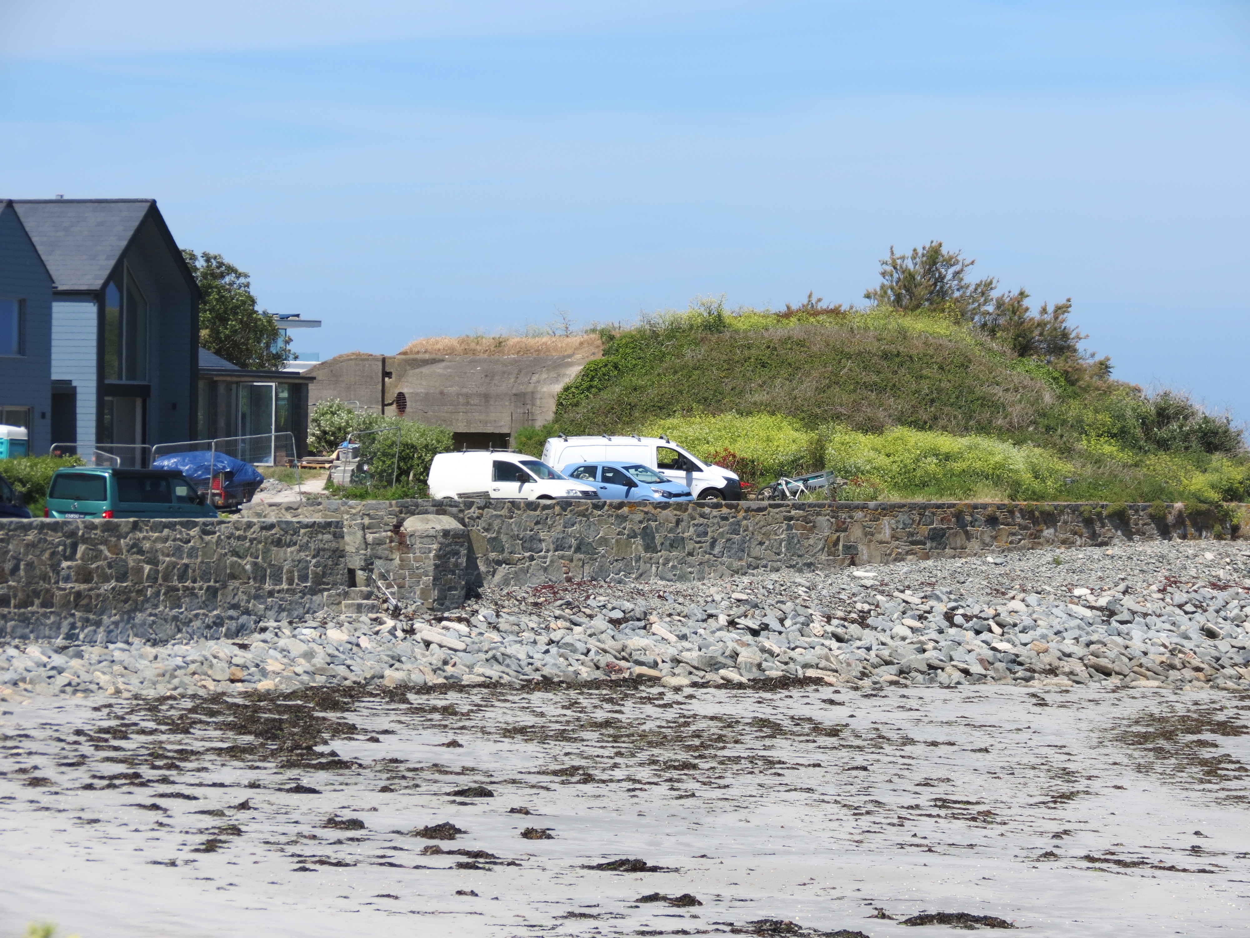
More bunkers along the way, of course. One source we consulted said the Channel Islands were the most intensively fortified area in history by World War II. Now, many of the bunkers are vanishing into the landscape, covered by soil and vegetation. For example:
The bus routes in the west hug the shore of Vazon Bay, and at most major bus stops, there's a snack shack. Usually fair to good quality in our experience. Since Shoshanna has been unable to meet her goal of eating her own weight in seafood before leaving the islands, I've made a point of looking for shacks with good options. Today, we found one that sold crab sandwiches. Shoshanna enjoyed hers, and I helped with the chips. (Culinary note: chips are the British-style chunky French fries, fries are American-style thin strips, and crisps are the bagged American-style potato chips.) I had a mint chocolate ice cream for dessert, and now have enough data to suggest that Jersey ice cream has a slight lead over Guernsey's. But that's a purely amateur opinion. More research is clearly necessary.
Matt, if you're reading the blog, you'll love this. As we were walking down the highway after lunch, I saw a vintage Aston Martin DB5 (the one James Bond drove in the 1960s movies) approaching fast, and I turned fast enough to see that his license plate was 007!
We arrived on the L'Erée coast opposite Lihou Island about an hour before the tide receded enough to expose the causeway leading to the island. The island's managed as a wildlife and breeding bird sanctuary, aided by the fact that the only easy way to get there is over a causeway that's only visible above the sea for a few hours per day. While we waited, we sat at the top of the slope leading down to the causeway and enjoyed the beautiful view of sun and aquamarine waves crashing in white foam over exposed rocks and barely submerged reefs. We waited until the outline of the causeway was clearly visible, then headed down the slope to find it.
Because of the tides, the people who manage the island recommend that you plan to allow 20 minutes coming and going, for a total of 40, then no more than about an hour on the island before you return home to ensure that you don't get caught by the rising tide. As elsewhere in the islands, the tide can come in very fast, and if you get caught by the tide, you could be swept from the causeway and dashed against the many rocks. They don't really advertise this well, other than as a small and easily ignored sign before you step onto the causeway.
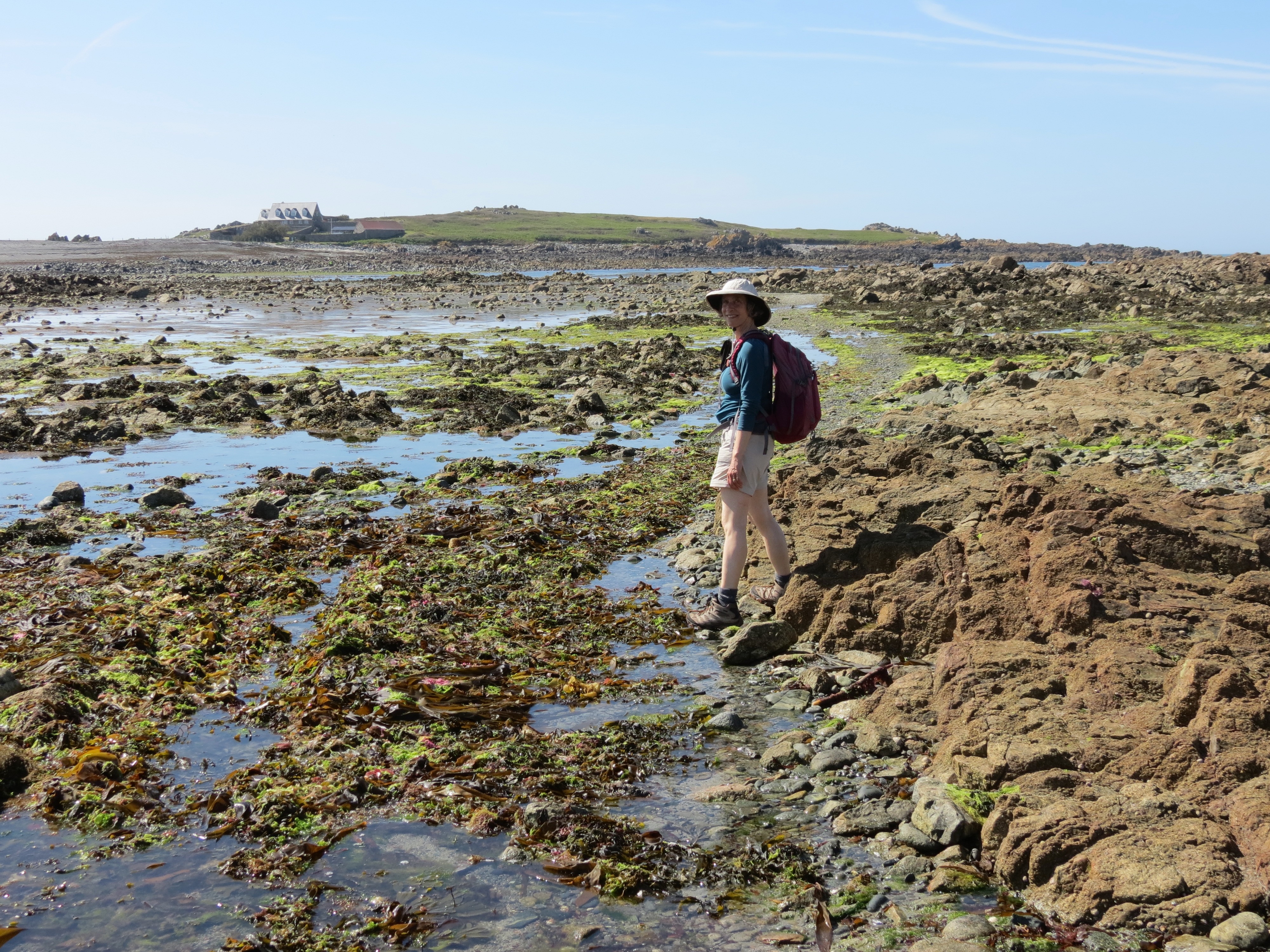
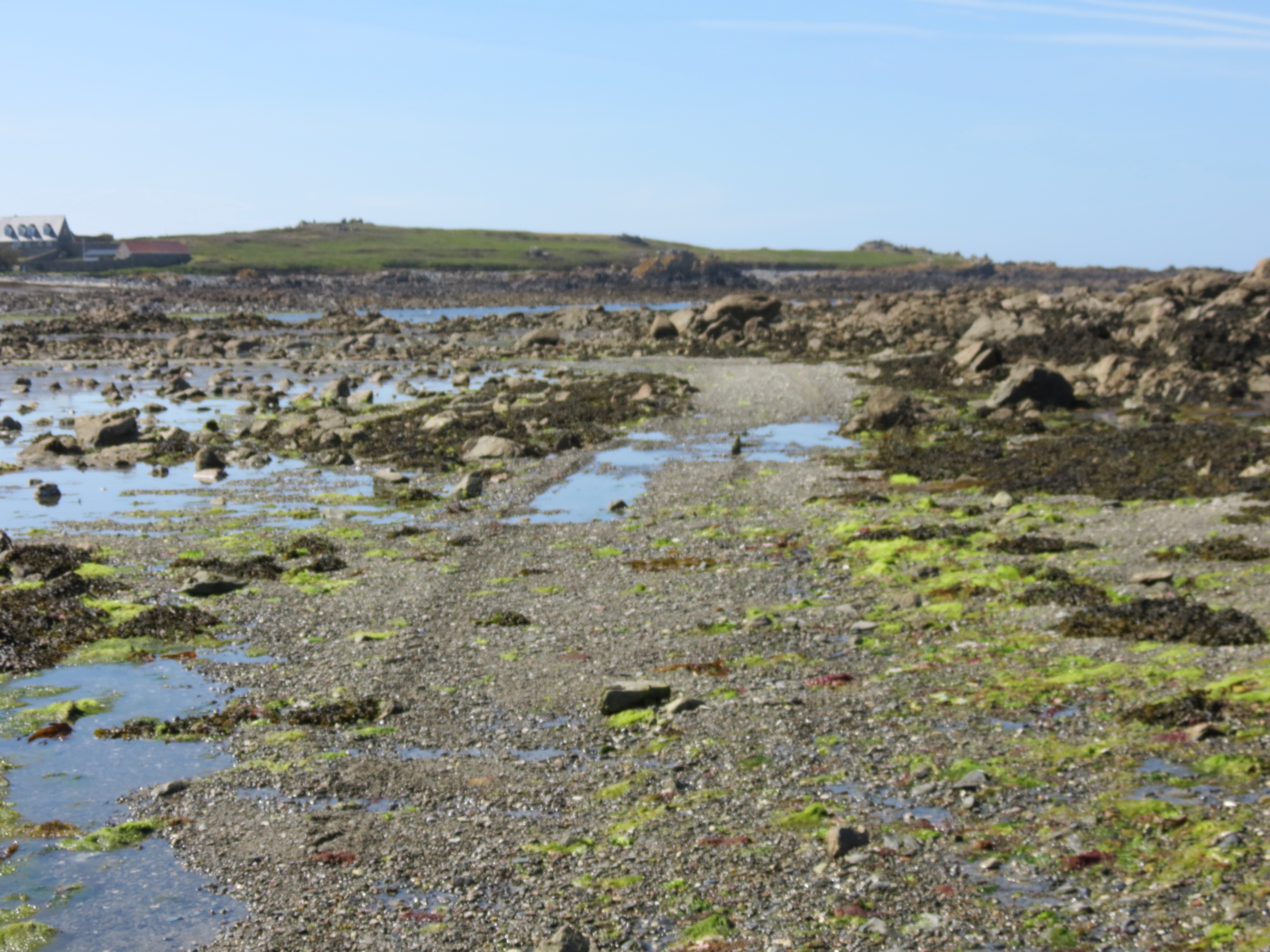
Walking along the causeway is tricky. The rocks are often covered by algae or 10+ cm of seaweed above a stony surface, with water running downhill into lower regions on and around the causeway, so it's quite slippery. We had a few close calls, but managed to avoid wiping out and landing amid the muck. The area we walked through to reach the castle would be underwater by at least 1 m and more likely 2 to 3 m.
Slippery and less slippery sections of the causeway:
After having a quick look around, we climbed back up to the road to catch our bus home. We got off about a third of a km down the road from The Deerhound. It was "Italian night", which means an all-you-can-eat hot table of various pasta dishes and other morsels, such as potato croquettes and thin-crust pizza, as well as a cold table with a range of different salads and breads, as well as a few cheeses. I opted for the buffet, with a pint of very good San Miguel beer, and Shoshanna chose scampi linguini, accompanied by a pint of Thatcher's hazy cider, followed by a "cheese board" with buttery cheddar, blue cheese, and a cheese with a firm yellow exterior and soft and crumbly white interior, served with crackers, watercress, and really good gingery chutney.
As we were leaving, we got to talking with an Irish husband and wife and one of their mothers. Nothing of major import, but friendly "where you from" level of conversation.
Another shared bath to get our feet in working order for tomorrow, and early to bed, since we have to leave to catch a bus by 9 AM if we don't want to miss our ferry to Sark.
©2004–2026 Geoffrey Hart. All rights reserved.