|
–Geoff-Hart.com:–Editing, Writing, and Translation —Home —Services —Books —Articles —Resources —Fiction —Contact me —Français |
You are here: Home (fiction) --> Channel Islands --> May 11: Jersey Island
Vous êtes ici : Accueil (fiction) --> Channel Islands --> May 11: Jersey Island
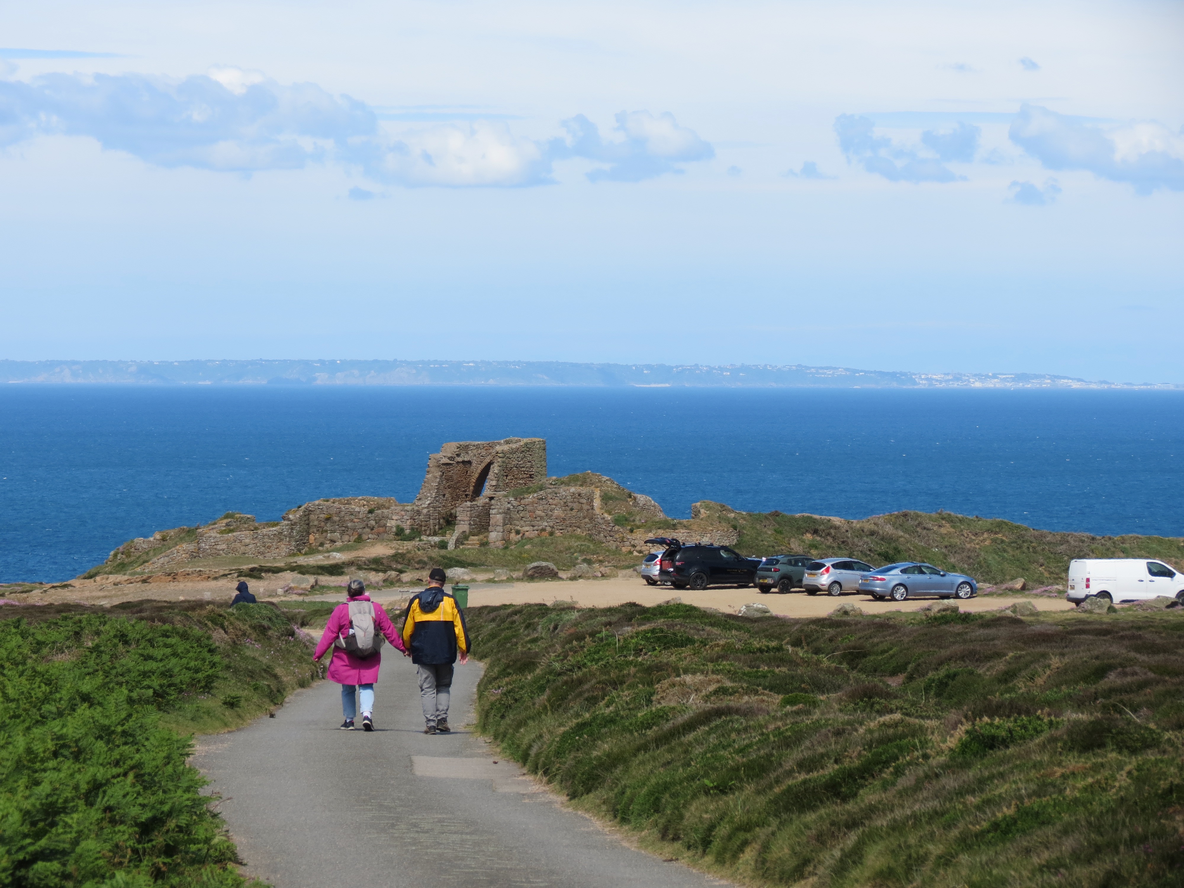
Today's hike was from the northwest corner of Jersey, starting at a place called Gros Nez (pronounced groan-ee by the bus driver rather than grow-nay in modern French), which means "big nose". It's not clear why, other than perhaps the coast sticks out like a big nose? Nope! Turns out it's from old Norse grar nes, which means a grey headland. After a few centuries of occupation by the French, the pronunciation changed to something more French. The hike moved eastward along the island's north shore, and although the coastal trail completely circumnavigates the island, we chose to end at "the Devil's hole", which may be a corruption and mistranslation of creux de vis, with "creux" meaning a big hole and "de vis" meaning a spiral or circular passage but potentially sounding like "devil". Details below on whether this is a reasonable explanation.
We took the first bus of the day that wasn't at a crazy hour (8 AM) and half an hour later, after a whirlwind tour of the center of the island, ended up at Gros Nez, which has a horse racing track and just had a big race yesterday that we missed. Since we were there to hike, we weren't particularly upset, though it's always a pleasure to watch horses. As we walked to the start of the trail, we were accompanied by a British couple who looked to be about 10 years older than us. They were doing geocaching, as they wanted to bag four local caches while they were in Jersey. Geocaching is a sport where you navigate via GPS to a location where someone has hidden something (e.g., a box containing a signature book to which you can add your signature) and record your feat. Seems sort of like birdwatching for technophiles.
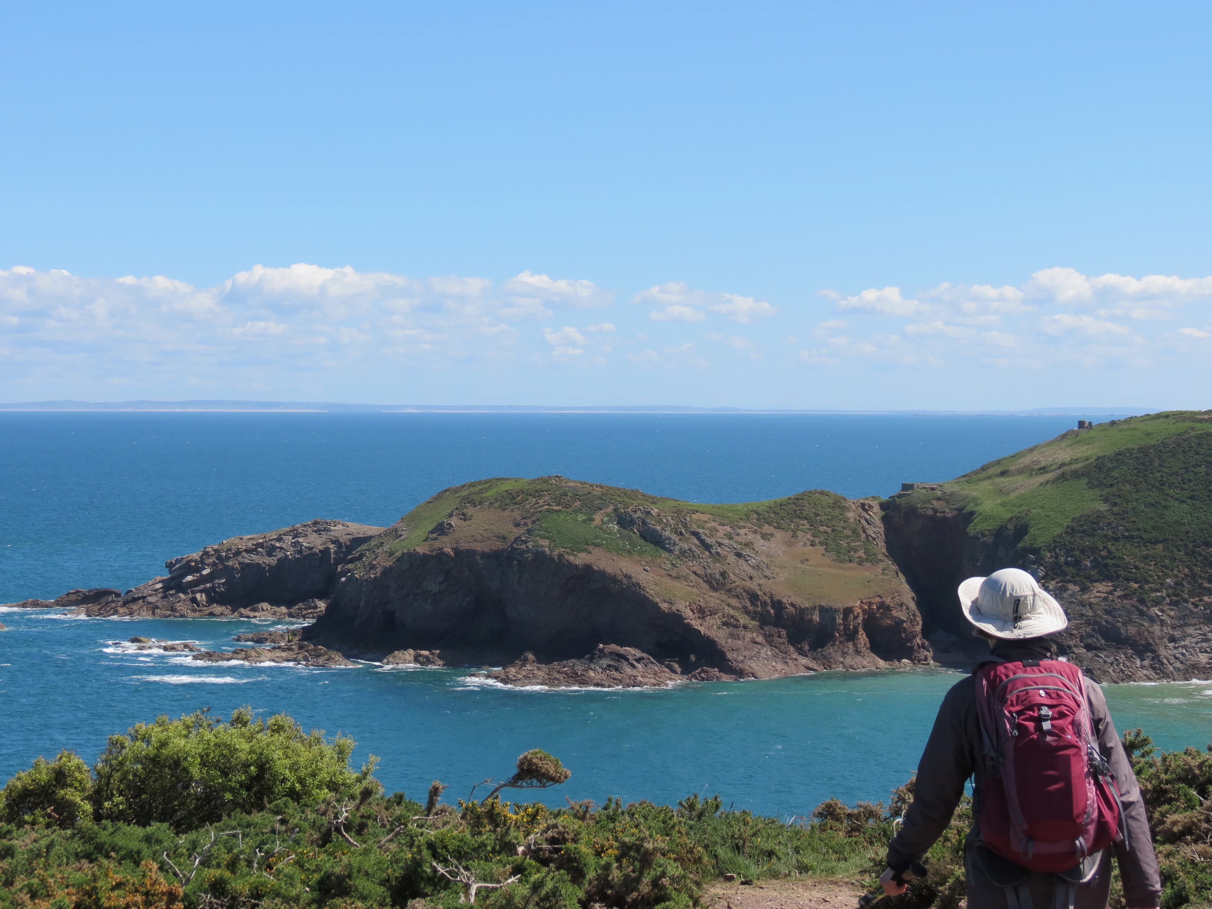
The walk along the coast, on cliffs high above the ocean, starts with a beautiful view of the sea. If it's a bright, sunny, cloud-free day, as it was during our hike, you can see Guernesey, Sark, and Herm islands way off in the distance; you can even see the coast of France, though it's too far to really make out anything more than distant cliffs. There were no bluebirds over the white cliffs, so probably not Dover unless our geography was really messed up.
Guernesey seen from Gros Nez:
Of the two segments of the hike, I think I preferred the path that took us to Grève de Lecq, of which grève means "beach" in French and vic means "bay" in Norse, so presumably "sandy beach". And it does have a small but pretty beach, complete with a nice little café/restaurant. Let me just state for the record that all long-distance hikes should have pubs or similar facilities at appropriate intervals. Very civilized!
We had beautiful sun, sparkling aquamarine water, and a cooling breeze, so it was perfect weather for hiking. Enough other people on the track to be social, but no so many as to clog the trails or fill the air with chatter. After a couple hours, we reached Grève de Lecq and Colleen's restaurant, where you can't get anything you want, but you can walk right in and sit right down while making clever musical allusions. We enjoyed a basket of well-fried chips with a quite hoppy Herm Gold ale that eased our thirst very well indeed. It's by Liberation Brewing corporation, which until recently was Jersey's oldest brewery (150 years) but recently relocated to Bristol, in England, for financial reasons.
Cliff from Gros Nez:

We gathered our gear and walked uphill to the public toilets, about 100 m down the road. All was well until I stepped out of the washroom and realized I'd left my camera behind at the restaurant. Ran back to the restaurant, and the waitress who'd been bussing tables recognized me and went to fetch my camera, which she'd grabbed before anyone could walk off with it. I thanked her with much thanks, and ran back to rejoin Shoshanna. Phew!
Beach at Grève de Lecq:

As we were leaving the beach area and climbing up into the hills, we came across some weird-looking livestock that resembled a weird cross between sheep and goat. Their shepherd happened to be there, and told us they were a breed called Manx Loaghtan (the latter word pronounced "lockton"), a rare sheep that's possibly of Viking origin. Unlike most sheep and goats, these guys have up to six horns: two sticking out straight like unicorn horns, two curled around the ear region, and two that we did not see because we were not among the illuminati granted such a sight. Funky sheep:
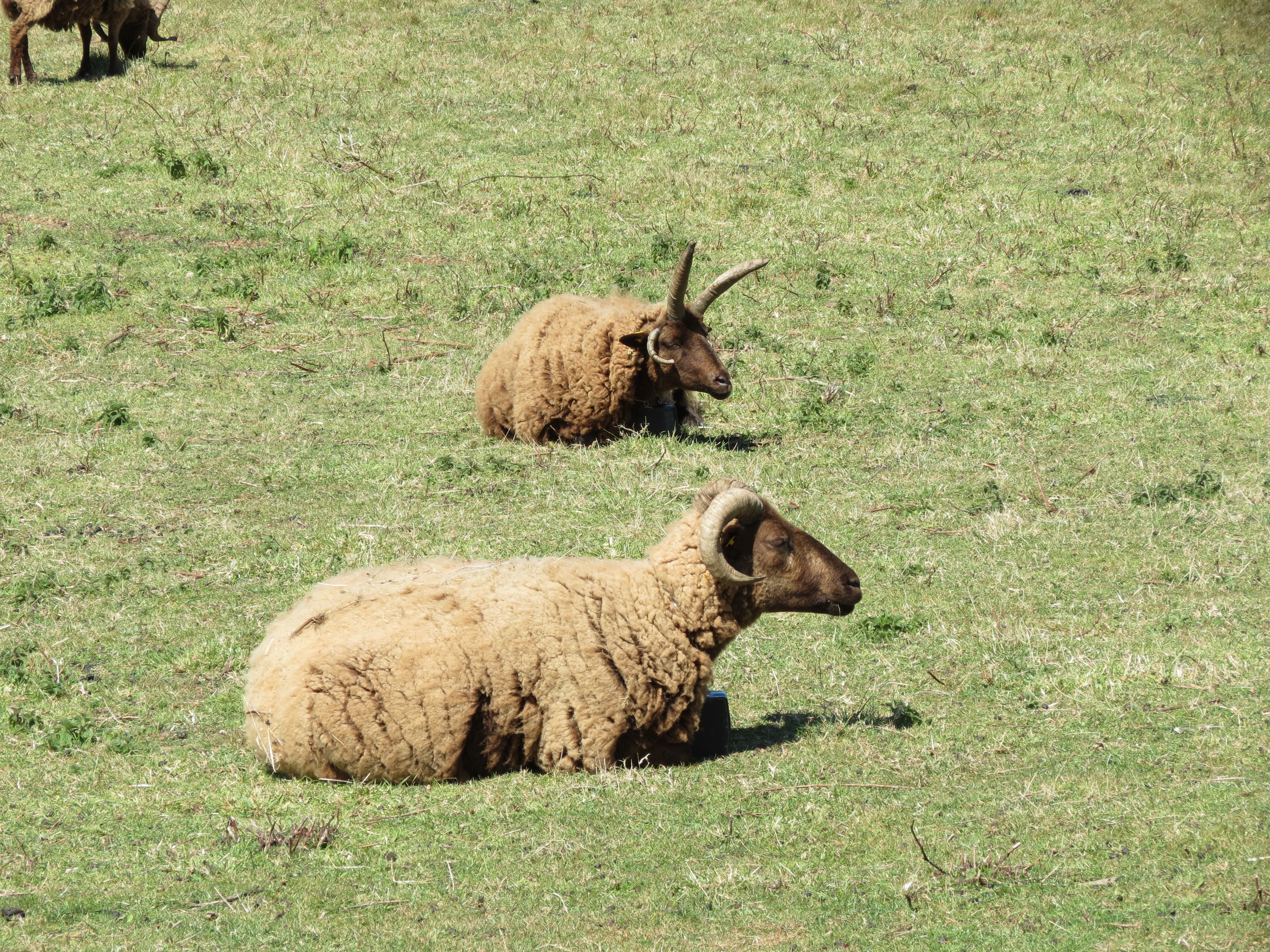
Although these sheep can be sheared, their wool can also just be plucked off when it's ripe and ready for harvseting. Alont the route we also saw several pheasants, including a mom with a batch of wee baby pheasants and a daddy pheasant with a big red-feathered head. Lots of hawks diving into the grass in search of critters for lunch, crows foraging in recently plowed fields, and gulls following behind tractors to pick bugs from the freshly turned soil.
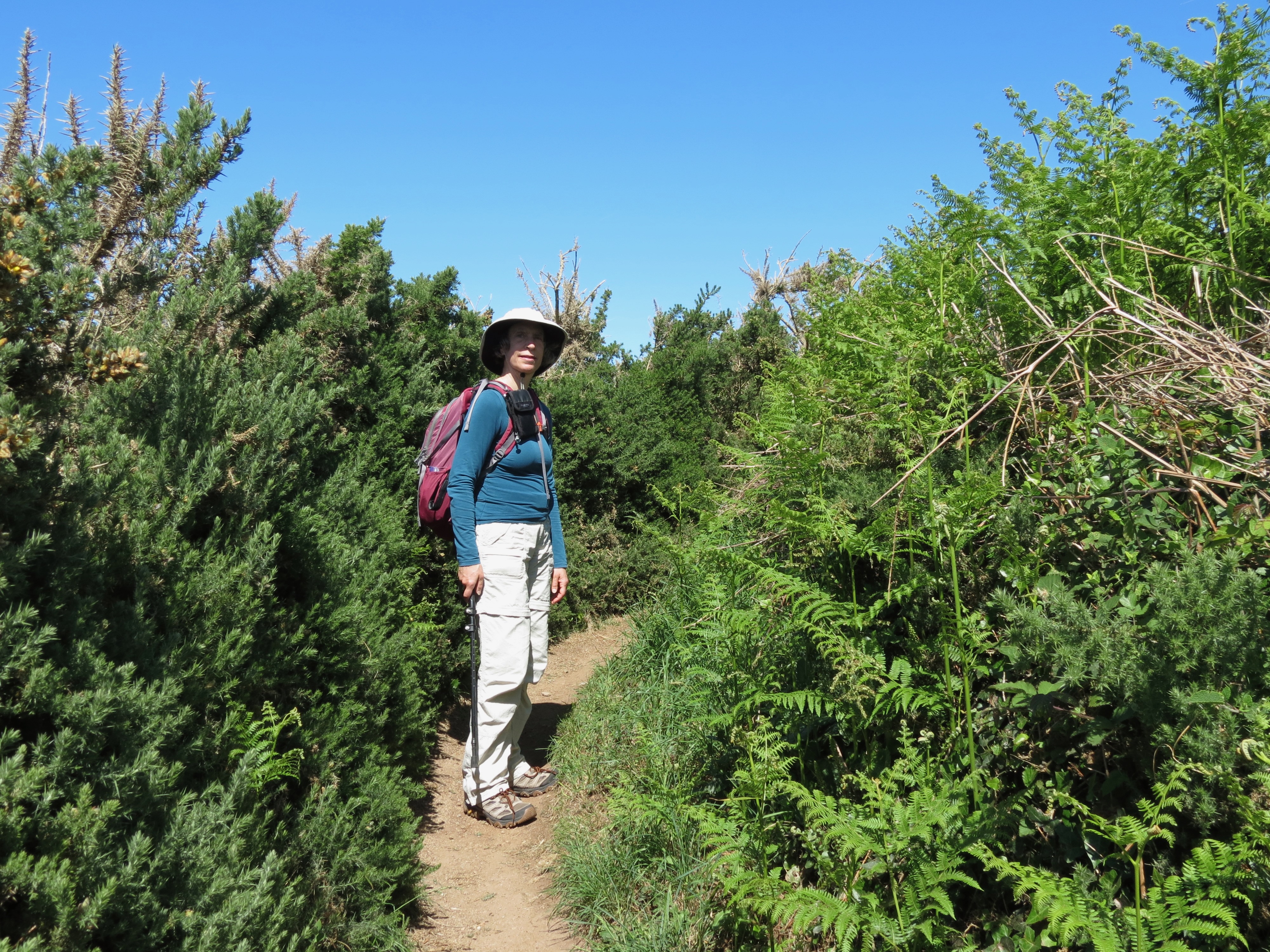
Shoshanna in a gorse-bordered stretch of the trail:
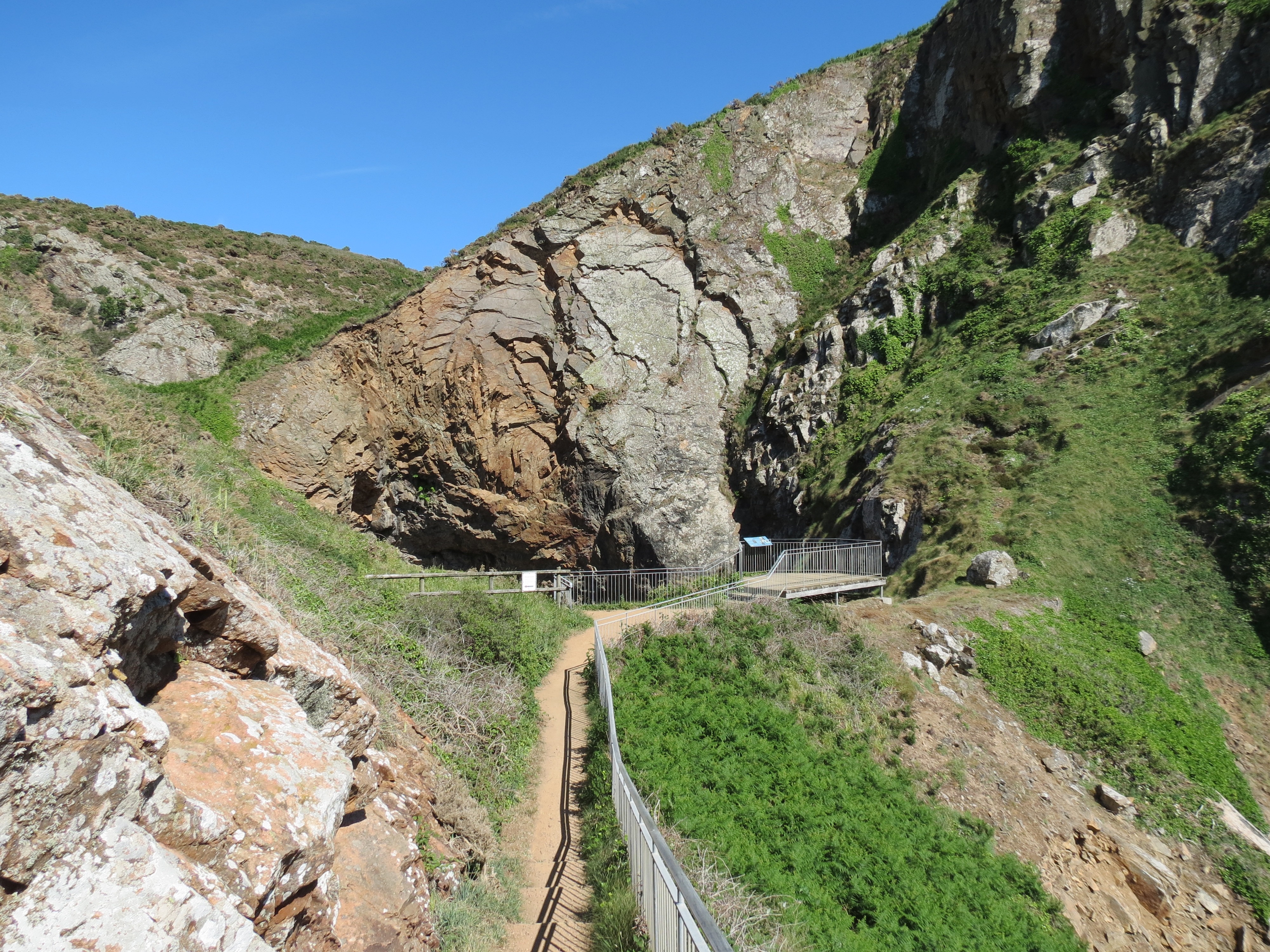
The last part of our hike, about another 2 hours, was to reach the Devil's hole, which is a part of the cliff where a spiral path has been carved through the rock by erosion, forming a deep cave that connects to the ocean. When the tide rises, the pressure of sea water on the shaft that lets water flow into the cave causes it to moan eerily, and the water froths up to add to the atmospheric effects. That seems like a far more realistic explanation of the name than suggesting that "de vis" sounds like "devil", which seems a bit of a stretch. Sadly, we arrived before the tide came in, so although we did see some water at the bottom, we didn't stay long enough to get the full effect. Among other things, we were quite fatigued by now and the bus back to St. Helier comes only every 2 hours and stops running at 7, so it might have been tricky getting back home had we stayed too long and missed the final bus of the day.
The Devil's hole:
This last part of the hike was less enjoyable than the first part. We had to navigate round the Crabbe gun and archery range, which is smack dab in the path. And in many places, the path is poorly marked, so we had to rely on our GPS to find the right option at several forks in the road. We used the Komoot software, which was particularly convenient because Jersey Tourism had made available a waypoint map of the entire hike. So when in doubt, we checked the sofware and didn't go astray.
I have to say how impressed I am by Jersey drivers, particularly those with large vehicles. Driving a bus in Jersey must be an anxiety-making profession. Most of the older roads were not designed for large vehicles; in a couple places, the bus barely made it through the gap between buildings or hedgerows. And even the more modern roads are quite narrow, making for a tight fit for buses and, for that matter, anything as big as a sport-ute car. The speed limits are kept low (typically less than 30 km/h and often as slow as 10 km/h) to give people time to maneuver, but nobody seems to pay much attention to the limits; instead, they barrel down the road, slowing only at the last minute when it's clear that the two vehicles might collide. If, upon closer inspection, it looks like a collision truly is imminent, they brake hard to a stop, then use some secret psychic protocol to decide who's going to back up until they can pull into a driveway or wide spot in the road. We've spent a couple hours on the buses getting from here to there, and so far haven't seen any accidents, collisions with pedestrians, or knocking over historical stone walls. I'm impressed at the skill required for these maneuvers, and have no regrets deciding not to rent a car to get around.
The tourism brochures claim the hike we did was 12.1 km long, with more than 300 m of elevation change (about 1000 feet), and we managed that distance in only 4 hours, which is pretty good for us old farts. Tomorrow the plan is to do much less walking: we'll visit the War Tunnels and the Hamptonne Country Life museum, which reconstructs a country farm back in the 1300s and up to the 20th century. Tours are led by docents with expertise in the various periods. Details tomorrow!
©2004–2026 Geoffrey Hart. All rights reserved.